The terrible DCR falsely claims sainthood on the Charles, ONCE AGAIN.
The following report was submitted in hard copy on December 1, 2022 to the Cambridge City Manager, and to the Cambridge City Clerk for the Cambridge City Council’s December 5, 2002 meeting, with a copy mailed to the Chair of the Cambridge Department of Public Works. Format and corresponding references are modified to fit the needs of this blog.
* * * *
1. Phil Barber reports
2. “Value,” coming destruction.
3. Partial History of the Shore of the Charles River at Magazine Beach. The playing fields, the area Phil’s sign lies of concern about.
A. DCR and Cambridge poisoned the Charles River through the Government Contractor who is pawned off as supposedly the TOTAL sum of interested people concerning the Charles River in this area.
B. The area being “protected.” according to the DCR propaganda / sign.
4. ADDENDUM: Cambridge Conservation Commission Meetings look like they have been essentially secret to the public since the beginning of 2022 or earlier.
Attachments:. The writer’s partial activist résumé; the last known depiction of DCR irresponsible plans at Magazine Beach. See below.
1. Phil Barber reports
Two Reports Edited and combined for better understanding by the Reader:
* * * *
There is a new sign at the fenced in area of the Magazine Beach playing fields- but no trees of the mentioned species were planted there (or were there originally) and the planted shrubs died from neglect the same season they were planted, what was it, four years ago.
[ed: here is the copy of the sign included in the report.]
Blames "goose droppings" for river pollution too.
However did nature manage before we came along?!
They also put up another sign about "invasives" and the need to police them lest they "crowd out native species". What utter nonsense. This isn't a pristine natural wetland, it's manmade landfill in the heart of a most unnatural ecosystem, a human city. Whatever flourishes there on its own accord is the native species! People can be such egomaniacal idiots. In every handful of soil at Magazine Beach there are literally billions of living organisms, 99.99% of which are unknown to science.
A third sign invites people to notice the bark on shrubs chewed on by cute little bunnies in the winter in their desperate struggle not to starve to death in the dying season. Look for signs of native animals, it says. The ones they also think they have the right to regulate. Pretty little songbirds, lovely, rats, evil!
One thing on that first sign, it does mention cottonwoods. It's vexed me no end that the idiots identify that stand of big cottonwoods as poplars in their plans. Not a small thing in my opinion for these dedicated nature buffs to make such a carelessly mistaken observation.
2. “Value,” coming destruction.
It is extremely difficult to nicely analyze the behavior of the Massachusetts Department of Conservation and Recreation and the Cambridge City Council, together with the supporting bastions of great language at Mass. Audubon and other lovely sounding entities.
Here is my video of the construction on the Charles River of which the latest outrages are a continuation https://www.youtube.com/watch?v=pTplCCEJP7o. This outrage was supported by lovely sounding entities.
The most important concept to understand is the word “value” as used by the construction lobby and friends of the construction lobby to which these entities pay homage.
“Value” in this world is value to a contractor.
[Ed: Red text box enclosed the following. Then resumed in normal text.
* * * *
● WHO MADE MONEY HERE?
● WHO CAN MAKE MONEY HERE?
* * * *
● ANYTHING WHICH DOES NOT PROVIDE MONEY TO THE CONTRACTORS HAS NO “VALUE” IN THEIR WORLD.
● Things which “lack value” are things which grow or live WITHOUT CONTRACTORS MAKING MONEY.
● EXISTING, MAGNIFICENT TREES AND FREE ANIMALS PROVIDE NO MONEY TO CONTRACTORS.
● IN THIS WORLD, EXCELLENT TREES, VEGETATION AND ANIMALS HAVE NO “VALUE.” BECAUSE NO CONTRACTOR IS MAKING MONEY FROM THEM.
● AS FAR AS THE CONTRACTORS ARE CONCERNED, THOSE EXCELLENT TREES, VEGETATION AND ANIMALS ARE IN THE WAY OF CONTRACTORS MAKING MONEY.
● SO DESTROY THEM, WHICH IS WHAT THE DCR AND CAMBRIDGE AND FRIENDS ARE DOING AND HAVE BEEN DOING.
My video of the beginning of this accelerating outrage shows their SICK value system in operation in January 2016. It is posted at https://www.youtube.com/watch?v=pTplCCEJP7o. This video includes destruction of the excellent Wild Area to the east of the BU Bridge in addition to the accomplished destruction of hundreds of trees between the BU and Longfellow Bridges. They did not get it done then, it seems to be targeted now. Comments in the video about outrages coming at the Magazine Beach playing fields have been started and worse.
The area destroyed in January 2016 was planned to run from the BU Bridge to the Longfellow Bridge, the second bridge east of the BU Bridge. For unknown reasons, the area nearest the BU Bridge was not destroyed THEN.
We will proceed with stills from “From Cambridge to Boston with the DJ Inspire 1 Drone footage,” https://www.youtube.com/watch?v=sN-OmMzvHhw. This first still is from minute 9.28.
The B.U. Bridge is slightly off camera below the bottom of the still. The first bridge above it is the Mass. Ave. Bridge. Barely visible beyond it is the Longfellow Bridge. Hundreds of mostly excellent trees as shown in the video were destroyed in this area.
Under the latest games, the Cambridge City Council looks like it is working with the DCR to destroy this thick woods, the Wild Area, through maneuvers which remove its destruction from public view. By the bizarre definitions which exist in this world, the ONLY “public” review will be by a government contractor who POISONED THE CHARLES RIVER as agent for the DCR with help from the City of Cambridge. Although she might invite some friends to rubber stamp her.
The building to the right of the Wild Area in this photo is across Memorial Drive from the bottom building in the above still.
The figures in the water are a group of the Charles River White Geese hunting for food.
Here, from minute 1.59 above the river is the EASTERN portion of the area currently being targeted by the DCR and the Cambridge City Council. For most of the last 42 years, this was the main land habitat of the tourist and resident loved Charles River White Geese.
To the far right, beyond the BU Bridge is the Destroyed Nesting Area of the Charles River White Geese and the Wild Area. The Charles River White Geese went to their nesting area in the spring and for protection against bad weather. Their habitat extended about over about a mile of the Charles River and its banks centered on the BU Bridge.
Here is a photo of part of the tourist and resident loved gaggle during the winter admiring the Charles from their Destroyed Nesting Area. They are standing under the railroad bridge, which is visible above their heads. Below the White Geese are visiting Canada Geese.
I have repeatedly provided the Cambridge City Council with the PUBLISHED destruction plans of the two destructive entities on Magazine Beach in the area shown and the area to its west / left in the photo. The report contrasts plans with photos of targeted trees. It is posted on the Charles River White Geese Blog at http://www.friendsofthewhitegeese.org/ar1.htm.
A lot of destruction has already been accomplished, featuring destruction with city funding. The funding votes have been accomplished with the maximum possible secrecy and without meaningful public presentation.
The original plans were to destroy 54 mostly excellent trees. That destruction number has passed 60.
Here are the destruction plans for the Destroyed Nesting Area of the Charles River White Geese and the Wild Area. A photo in live is on page 3, above.
Below are the destruction plans which have been pending since 2009 for the Wild Area, but have NOT YET been implemented.
The Wild Area is the thick wood to the right of the Railroad both in the photo on page 3 and in the 2009 plans. In the plans the railroad is the thin vaguely diagonal and vertical lines running up and down in the middle.
Note that EXACTLY ONE tree is NOT DESTROYED in the plan. The most recent outrage is games by the Cambridge City Council and the DCR apparently to proceed with destruction AS SECRETLY AS POSSIBLE.
The following enlargement blows up the ONE TREE (number 535) not being destroyed and the lying code which gives the impression that the map is meaningful while omitting almost all trees in the Wild Area..
Future plans are to be “publicly” reviewed ONLY by the GOVERNMENT CONTRACTOR who poisoned the Charles River for the DCR (see following section). She may or may not invite friends to rubber stamp her. This is a GOVERNMENT BREAK-OUT of THE LATEST, DELIBERATELY SECRET initiative. The break-out would have “meaningful public review” far less than even “meaningful” reviews as such “reviews” are allowed in Cambridge with its fake protective groups so common.
Details are posted at: https://charlesriverwhitegeeseblog.blogspot.com/2022/07/memorial-drive-phase-3-fraud-on-charles_27.html.
3. Partial History of the Shore of the Charles River at Magazine Beach. The playing fields, the area Phil’s sign lies of concern about.
A. DCR and Cambridge poisoned the Charles River through the Government Contractor who is pawned off as supposedly the TOTAL sum of interested people concerning the Charles River in this area.
The native and non-native terms as used on the Charles River fit the same mold as “VALUE” and “NO VALUE.” In the bizarre world with whom we are dealing. Excellent vegetation and the LAST REFUGE OF FREE ANIMALS ON THE CHARLES RIVER (the Wild Area, and to its left in the above presentations) have “NO VALUE.”
Contractors are not making money on them.
Here is another sign which has been on Magazine Beach longer. This is my compilation of three photos by Phil to present that hypocrisy.
The sign explicitly says the DCR and Cambridge are preventing poisoning of the Charles River by poisons INTRODUCED INTO THIS FORMERLY PRISTINE AREA BY THE TWO IN THE LATE 2000's.
Here is how the DCR through the Charles River Poisoner poisoned the Charles River, WITH DCR MONEY AND DCR “volunteers” mostly from outside of Cambridge.
First, here is a still from Minute 10.26. It is a blow up of a much closer shot than provided above.
The Starvation Wall at the top deliberately takes their food away from the Charles River White Geese, along with the introduction of poisoning of that food after a Century in which Magazine Beach had been pristine.
The areas of vegetation below the Starvation Wall were created to drain the DCR and Cambridge poisons off and KEEP THEM OUT OF THE CHARLES RIVER as is stated on the above sign.
The Charles River Poisoner and her DCR funders were horrified to see vegetation in the drainage area that did not have payments to contractors involved in their growth.
The Charles River Poisoner, using “volunteers” and funds supplied by the DCR including Trump moneys destroyed much of the protective vegetation in the area created to KEEP THE DCR / CAMBRIDGE POISONS OUT OF THE CHARLES RIVER.
Here is part of what they did to “defend” the Charles from UNPAID, FREE EXCELLENT VEGETATION.December 1, 2022 [ed. this date is date of submittal of the letter. Apparently erroneously inserted in the text by a robot and I missed the "improvement." Love those robots.]
They tore up healthy, vibrant vegetation and REPLACED IT WITH PLASTIC.
Here is a City of Cambridge truck picking up the valuable vegetation DESTROYED BY THE CHARLES RIVER POISONER who is now the only entity allowed to participate in public review of projects in this area. This and the damage photo were taken on December 7, 2017:
Here is a photo by Phil Barber from the river end of the destruction, to the left of the MEANINGFULLY INTRODUCED BLACK PLASTIC in the above photo. May 2, 2018.
Here are Phil Barber photos of the algae which formed in the Charles River next to the Starvation Wall. September 3, 2018.
Come 2019, the Charles River was so overrun with this stuff that a fake protective group which supported the January 2016 outrages started yelling about algae infestation.
At no time did any of the various fake protective groups associated with the DCR or the Cambridge City Council bother to notice the CREATION OF THE POISONS IN THE CHARLES RIVER BY THE DCR AND CAMBRIDGE THROUGH THE CHARLES RIVER POISONER.
Subsequently, the DCR with Cambridge funding supported an apparent boondoggle to clean up the poisoning which was CREATED BY THE DCR AND CAMBRIDGE THROUGH THE CHARLES RIVER POISONER. I am unaware of any cessation by the DCR and Cambridge of their poison dumping next to the Charles River.
On the Boston side of the Charles River, A RESPONSIBLE AGENCY, the Massachusetts Department of Transportation is working on rebuilding Interstate 90, a.k.a. The Massachusetts Turnpike, to correct deterioration of a raised portion because of age. They are also straightening it out in an area which was formerly a rail yard. This area abuts the western portion of Boston University and a residential neighborhood, plus the commercial district known as Allston Village.
The future resident (and current owner) of the rail yard is Harvard University. This area is very clearly Harvard’s coming relocation of the professional schools which share the Harvard / Longwood Medical Area with massively expanding hospitals. Harvard has floated its idea for a Deep Bore Red Line Subway spur to connect Harvard Square, the Allston Village Campus and the area in which the Harvard / Longwood Medical area is located.
Cambridge’s City Council has massively upzoned Harvard Square, rewarding Harvard to move facilities in Harvard Square to Harvard’s coming Allston Village Campus. Harvard’s coming Allston Village campus is triangular, with the top of the triangle near the Allston Village business district. That point is the obvious location for university housing, both moved from Harvard Square (thanks to the Cambridge City Council) and as needed to support the uses moved from the Harvard / Longwood Medical Area.
The Allston Village business district has been allowed to slide, obviously deferring maintenance for the coming campus AND COMING STUDENTS. It already is a student Mecca, particularly for Boston University and Boston College. It could readily replace the Harvard Square student Mecca.
As part of the legislature’s destruction of the Metropolitan District Commission, the Massachusetts Department of Conservation and Recreation is tasked with management of open space being created in the process.
I have publicly questioned the DCR in an advisory committee meeting on the I90 Rebuild / Allston Village Campus project to determine if they intend to duplicate there the poisoning THEY AND CAMBRIDGE HAVE INSERTED ON THE CAMBRIDGE SIDE.
The DCR refused to comment.
Until about 2010 or so, the Metropolitan District Commission was responsible for all state lands abutting the Charles River. The legislature destroyed the MDC. Members of the legislature said they were responding to the destructiveness of the MDC. Open space went to the DCR. Highways went to the Massachusetts Department of Transportation.
The terrible plans of the MDC are what underlie the outrages on the Cambridge side. “Planners” of the MDC moved to the DCR and resumed destruction, WITH CAMBRIDGE SUPPORT.
MassDOT has frequently looked like the adult in the room with two spoiled, destructive brats.
Here, from minute 10.02 is a still of Harvard’s future Allston Village Campus.
B. The area being “protected.” according to the DCR propaganda / sign.
Here is a photo of the Charles River at the Playing Fields at the beginning of this outrage. This shot was taken in mid-2006. I think the photo was taken by a representative of the Metropolitan Water Resource Agency.
This is part of a collection of these photos. It was taken as part of a memorial which was front paged on the Cambridge Chronicle in 2006.
A service was conducted at that time on the environmental facility between the playing fields and the BU Bridge. It was taken with the assistance of the MWRA which owns the facility, and which brought the original gaggle to the facility for protection. Their guard dog passed away so they got White Geese who would raise a racket if a trespasser entered the pollution processing plan area.
The memorial was for Bumpy, the long time leader of the gaggle of the Charles River White Geese. A nut assassinated him in 2001. The nut had apparently been killing nesting geese. Friends of the White Geese begged the Cambridge City Council for protection. They ignored our requests. So the nut and friends raped and murdered a woman under and on the railroad bridge. The Cambridge City Council spent an hour discussing the rape and murder. They did not want to know WHERE it occurred. One City Councilor accidentally mentioned the location. She swallowed her words, looked around guiltily and joined her accomplices in not mentioning the location.
The Charles River White Geese, for most of the last 42 years fed and lived at Magazine Beach playing fields.
Here is the first view of the Charles River White Geese of the “improvements.” on September 4, 2008.
The Boston Sunday Globe featured a report on this act of heartless abuse. The report led an internal section of the paper.
Remember the sainted Charles River Master Plan as written called for a “Lawn to the River.”
Here is the riverfront in 2012.
After the outrage to the left was created blocking access, the Charles River Master Plan was amended to delete the promised lawn to the river and allow this outrage.
And a cross section at the same time.
And from the Boston side.
The DCR and Cambridge walled off the banks of the Charles River with a bizarre wall of vegetation INSTEAD OF THE LAWN TO THE RIVER PROMISED IN THE SAINTED CHARLES RIVER MASTER PLAN AS PUBLISHED.
Sane people hated this bizarre wall since it made the Magazine Beach playing fields the equivalent of facilities ten miles from the Charles River.
By April 2021, the supposed protective work had started which is advertised by that sign which Phil blasted above
This is part of the area shown three pictures above and is a few hundred feet west of the cross section.
Instead of that wall 16 feet or more high, they are creating a wall six feet or so high in this area. People and animals are still kept from traveling between most of the playing fields and the adjoining Charles River. AND, AS FAR AS I KNOW, THE POISONS CONTINUE TO BE DUMPED ON THESE BANKS OF THE CHARLES RIVER.
Later in 2021:
Magazine Beach survived very well before 1997 or so when the Later Court Condemned City Manager Robert Healy and his fake protective groups started to publicize “improvements.” Since then, the destructiveness of the incompetents far exceeds what little good they have done.
[A footnote was inserted after the mention of Robert Healy. It read as follows]
* * * * *
Monteiro v. Cambridge, trial court decision is posted at: http://charlesriverwhitegeeseblog.blogspot.com/2009/04/judge-issues-decision-denying.html. Appeals Court panel’s comments are posted at: http://charlesriverwhitegeeseblog.blogspot.com/2011/08/appeals-court-decision-in-monteiro.html. I say “comments” with care. The Appeals Court panel SPECIFICALLY REFUSED TO DIGNIFY THE APPEAL OF THE CAMBRIDGE CITY COUNCIL SUFFICIENTLY TO CALL THEIR COMMENTS AN “OPINION.” This was an employee / women’s rights case in which Judge and Jury roundly damned Healy for destroying the life of a minority department manager because she had the nerve to expect equal pay for equal work. The sequence of opinions may be summarized in one word about his behavior: “reprehensible.” The guilty City Council saw one incumbent clearly fired in the next election, and a second fired for multiple reasons probably including this outrage during the next election. [ed: sloppy wording. the second "next election is intended to refer to the election after the immediately following election.]
* * * *
Destruction of one of these fake protective groups was one of Friends of the White Geese’ first projects.
Healy was the middle of three related City Managers who assisted in the creation of a very real machine of what clearly look like fake protective groups which fool well meaning people into behavior contrary to their wishes.
One of the first things the City Manager machine did when it returned to Cambridge in about 1974 was to declare that they wanted to create “neighborhood associations.” One big reason was very clearly that the sire of the City Manager line, James Leo Sullivant and his then assistant, Robert Healy, were fired about seven years earlier as the result of INDEPENDENT groups organizing against the behavior of James Leo and friends.
Since the return of James Leo and the court condemned Robert Healy, a lot of “protective groups” predictably have appeared when the city’s development department has some sort of wild idea. The “protective groups” sound great but have a strong tendency to deliver the opposite of what they claim to stand for.
Magazine Beach has been a tourist attraction because of the gaggle of free Charles River White Geese which have lived there for most of the last 42 years since the MWRA brought in their ancestors to protect the pollution control plant.
The “plans” upon which the outrage was based included a” Charles River Master Plan” which supposedly is sainted, but which was almost immediately violated. The plans called for a “lawn to the river” at the Magazine Beach playing fields which were the home most of the year of the beloved Charles River White geese.
The DCR and Cambridge provided the Starvation Wall to starve the Charles River White Geese, plus they started dumping poisons on the grass, their food.
The latest nonsense is the DCR / Cambridge City Council response to sane people objecting that the starvation wall created a situation where the Magazine Beach playing fields might as well be ten miles from the Charles River. This silly addition is silly.
From the point of view of the heartless animal abusers at the DCR and Cambridge City Council, it continues their heartless abuse of the Charles River by blocking access to their food while also, it would appear, continuing to poison that food.
4. ADDENDUM: Cambridge Conservation Commission Meetings look like they have been essentially secret to the public since the beginning of 2022.
Probably the most useful information on the outrages on the Charles River has been divulged at the meetings of the Cambridge Conservation Commission. I have been taken off the mailing list for agenda and that status has not been renewed in spite of various requests, including written requests to the City Council and City Manager
Here is a screen shot as of November 22, 2022, from the city’s on line records demonstrating that agendas, PREVIOUSLY AVAILABLE ON LINE TO THE PUBLIC, ARE NOW AS SECRET AS THE PENDING OUTRAGES ON THE CHARLES.
Agendas appear partially available to the public through the end of 2021. They now look like they are for all practical purposes secret unless you go to staff and request particular papers. But first you need to know what to look for.
Sincerely,
Robert J. La Trémouille, Chair
Friends of the White Geese
cc: Owen O'Riordan, Commissioner
Cambridge Department of Public Works
147 Hampshire St.
Cambridge, MA 02139
Please note section 4 above. We object.
Attachments [presented immediately following]:
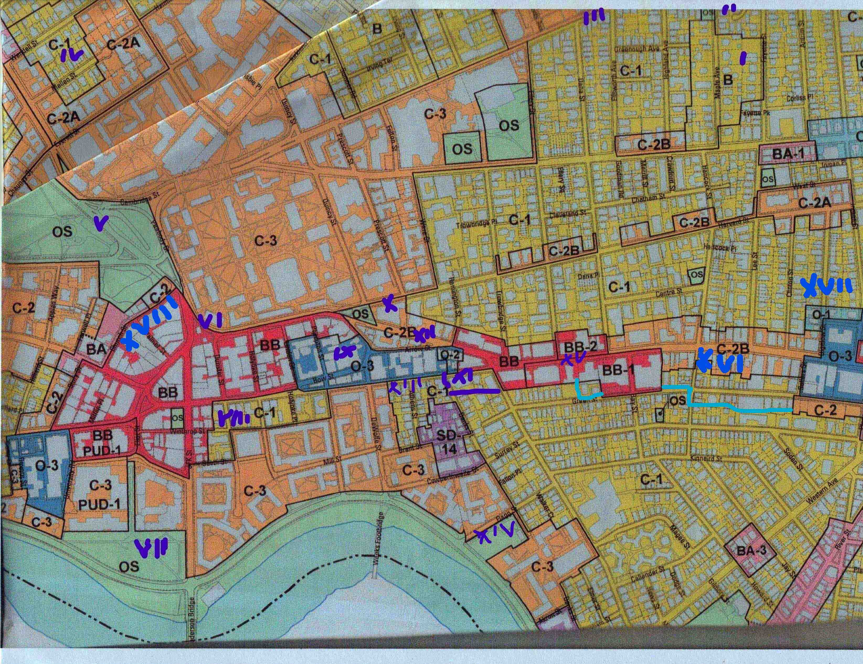
1. A partial rendition of the author’s activist résumé showing property in the most controversial parts of Cambridge.
2. DCR generated map of plans agreed to by the Charles River Poisoner and provided by her to the Cambridge City Council in 2019. I have divided up the plan into three parts for convenience of view. These are not official filings of the DCR. They are filings by the GOVERNMENT CONTRACTOR who is presented to the public and government agencies as the equivalent of a meaningful neighborhood association.
Attachment 1
Attachment 2