Wednesday, May 25, 2016

Mass. Pike Expansion (I90) across from Goose Habitat gets smaller.

RE: Mass Pike Expansion (I90) across from Goose Habitat gets smaller.

1. General.
2. Specific.
A. MBTA.
B. Recent vileness from Cambridge, DCR and cheerleaders.
C. MassDOT.
2. Official Announcement.


1. General.

Today, we have received some excellent information from the Massachusetts Department of Transportation.

The Charles River White Geese have the misfortune of living in the middle of a massive amount of possible development.

The very terrible actors are the City of Cambridge, the state’s Department of Conservation and Recreation, and fake groups which can best be described as falsely named cheerleaders for the City of Cambridge, Cambridge’s friends, and individuals possible worse than Cambridge ad the DCR.

MassDOT has been the adult in the room, and MassDOT, once again, lives up to expectations.

2. Specific.

A. MBTA.

Here is a map from the local transit authority, the MBTA, which brings a lot into focus.


This particular map shows a possible crossing of the Charles River for the Heavy Rail “Urban Ring” subway proposal, a crossing which was made an official alternative of the MBTA in 1991, after I proposed it in 1986.

Last I heard, Cambridge and those influenced by Cambridge had spent a minimum of 20 years denying the existence of this MBTA proposal.  Cambridge and friends want a destructive alternative river crossing which, increasingly, looks impossible because of the major upgrade of a Commuter Rail station called the “Yawkey Station.”  They are losing in reality, so Cambridge and friends indulged in blatant lies over a period exceeding 20 years.

The MBTA is now part of MassDOT.  MassDOT has made another major favorable ruling.

B. Recent vileness from Cambridge, DCR and cheerleaders.

Cambridge and the DCR have destroyed hundreds of trees between the BU and Longfellow Bridges on the Cambridge side of the Charles River.  The BU Bridge is to the left of the river crossing in the map.  The Longfellow Bridge is the second bridge to the right of the crossing.

Our video on this latest outrage may be viewed on YouTube at https://youtu.be/h_u-woTPRJ8.

The Charles River White Geese have lived in this world for more than 35 years.

When Cambridge and the DCR started their attacks on the environment, the habitat of the Charles River White Geese ran on the Charles River from the lower of the two bridges on the left (the River Street Bridge) to the proposed river crossing.

They are now confined without food in their Destroyed Nesting Area to the right of the BU Bridge on the Cambridge (upper) side and areas to which they can swim.

C. MassDOT.

The area of current concern to MassDOT is at the far left of the map.  It extends below the Charles River from the left margin, through the “90" (I90, Mass. Pike) to the BU Bridge.  The highway shown is the Mass. Pike and its current ramps off the Mass. Pike to Cambridge and the Allston / Brighton neighborhoods of Boston.

Here are MassDOT’s latest plans before this announcement, that I am aware of.  I split one map in half to keep my scanner happy.


The existing layout of the Mass. Pike (I90) in this area is greyed in under the colored proposed rearrangement.

The yellowed highway running from left to right through the combined map and then changing to blue and orange toward the right is the proposed relocation of the Mass. Pike (I90).

Between it and another, smaller parallel local road, and under both of them was intended to be storage for commuter rail trains going into and out of South Station several miles to the east (right).

The report is that this storage yard will not be going there.  Where the storage will be going is spelled out in the email I just received from MassDOT.

That frees up this space for other uses.  It decreases costs and greatly decreases pressure on the project.

So far, MassDOT has stoop up to outrageous proposals from friends of Cambridge and the DCR which would have accomplished further destruction on the Cambridge side consistent with the massive destruction already achieved and other irresponsible expansions proposed in concert with that outrage.

Hopefully, MassDOT will continue to be the adult in the room.

2. Official Announcement.

Here, without edit, is the MassDOT announcement.

* * *

Dear Friends of South Station,
1. We are writing to update you on MassDOT’s plan to submit a Final Environmental Impact Report (FEIR) for the South Station Expansion Project early this summer. The FEIR will include a preferred South Station Expansion alternative, summarize any changes to the project since the Draft Environmental Impact Report (DEIR) filing, and incorporate the additional environmental analysis outlined in the Certificate on the DEIR. The FEIR will also respond to comments made on the DEIR.
The FEIR consists of four primary components:
Expanding South Station to accommodate additional platforms, tracks, a new expanded headhouse, and passenger amenities
Acquiring and demolishing the United States Postal Service (USPS) facility
Constructing rail layover facilities at Widett Circle and Readville – Yard 2
Reopening Dorchester Avenue and extending the Harborwalk
MassDOT is developing the FEIR filing schedule, public meeting date and additional materials. We will share the schedule for filing the FEIR with the Secretary of Energy and Environmental Affairs as soon as details are available. There will be a public meeting on the FEIR during the comment period.
In preparing for the release of the FEIR document, MassDOT is hosting two community meetings in neighborhoods near the proposed midday layover facilities. On Tuesday, June 7, there will be a meeting in the Community Room at Boston Police District E-18, 1249 Hyde Park Avenue, Hyde Park, at 6:00 PM. On Wednesday, June 8, there will be a meeting at the Courtyard by Marriott-South Boston, 63 R Boston Street, South Boston, at 6:00 PM. Please visit the project website for meeting flyers and project materials.
The project will provide more reliable service for the MBTA’s customers and for the Northeast Corridor. We look forward to discussing the FEIR with you.
For more information about the South Station Expansion Project, please visit www.mass.gov/massdot/southstationexpansion. Please share this message with others who may be interested.
Sincerely,
South Station Expansion Project Team

Monday, May 23, 2016

Press Release: YouTube Video on Charles River Destruction.

Friends of the White Geese have Released the following.

The press release did not include photos.  I have added some.

RE: IMM RELEASE: Charles River Destruction Video posted on YouTube

PRESS RELEASE, FOR IMMEDIATE RELEASE
CONTACTS AT END OF REPORT.

Friends of the White Geese has announced the posting of a detailed video on YouTube concerning what they call "outrageous" destruction this year on the Charles River, including the impacts on the Charles River White Geese.

The video is entitled “The Destruction of Memorial Drive, Charles River, Cambridge, MA, USA, January - February 2016, 3d Ed.”  It is posted at https://youtu.be/h_u-woTPRJ8.


More than 100 photographs are included in the report.  The photos presented were taken on site.  They show before and after pictures, plus actual photos during destruction, maps of the destruction area, and destruction plans.  The report includes purported evidence of destruction which even exceeded the destruction listed in the plans.  The destruction comes years after original approvals of the less extensive destruction expired under law.

Almost all of the destruction occurred in January 2016.

The photos include before and after pictures between the BU Bridge and Mass. Ave. Bridge (halfway between the BU and Longfellow Bridges).


There are powerful photos both of the destruction of the magnificent Cherry Grove at the Memorial Drive split, and of the destruction of the magnificent grove of ancient trees at the heart of the MIT campus.  Destruction photos presented in the report include photos taken IN PROCESS.


The photos of the destruction between the Mass. Ave. Bridge and Longfellow Bridge were all taken during destruction by the DCR contractors.

All destruction was blessed by the City of Cambridge.

The report has integrated in it an update to reflect further destruction in late February near the BU Boathouse.  The destruction was located between the Hyatt Regency Hotel and the BU Boathouse.  The BU Boathouse, in turn has only the Destroyed Nesting Area, the Grand Junction Railroad, and the Wild Area between it and the BU Bridge.

The video goes into DESTRUCTION YET TO COME, and reflects destruction and heartless animal abuse both in the main area of concern, but also on Magazine Beach, to the west of the BU Bridge.  The information page fills in additional information.

A preliminary version of this report has been cablecast on Cambridge, MA, Cable Channel 8 by Cambridge Community Television, with Internet availability.  The report has been studied in a review session at CCTV Cambridge.  The 3d edition includes modifications to allow for comments in that forum and from elsewhere.

The video is an expansion of presentations made on the Cambridge Environment show on CCTV Cambridge, channel 9 primarily on February 7, 2016.  It includes introductory information from the show on March 27 and information on subsequent destruction in February 2016.  The content has been edited to present introductory materials and to edit the February 7 show to create a presentation starting at the BU Bridge and extending to the Longfellow Bridge.

Added to the original presentation on Cambridge Community Television are photos, maps, and destruction plans.  The photos are the work product of Robert J. La Trémouille, chair, Friends of the White Geese.  Maps and destruction plans are included taken from materials created by the Department of Conservation and Recreation.

Comments received to date have been highly favorable on the video report.  Suggestions received made the video more powerful than the original edition.  Those suggestions are appreciated by Friends of the White Geese.

Robert J. La Trémouille, Chair, Friends of the White Geese comments:

“I hope our response to comments  is considered adequate by the contributors.

“The changes made from the prior editions go more into the heartless animal abuse involved, by the DCR and Cambridge.  The changes analyze the apparently massive increase coming in the already inexcusable use of poisons on the banks of the Charles.

“Our biggest regret is that we did not have room in this report to go more into the outrages planned at Magazine Beach.  There is only so much you can report at one time.”

Friends of the White Geese is a Massachusetts charitable organization registered with the Attorney General.  It has been active since March 2000.

The purpose for which Friends of the White is founded is to defend the environment of the Charles River and living beings residing therein from any and all harm.  The organization has had extensive activities defending the Charles River.  Its activities, in particular, have concerned destruction initiating in the City of Cambridge and in the state's Department of Conservation and Recreation.  The organization considers Cambridge and the DCR the biggest environmental threats on the Charles River.

The organization supports the replacement of the DCR on the Charles River by the Massachusetts Department of Transportation which it describes as the “adult in the room” which it shares with  Cambridge and the DCR

The organization advocates the firing of the Cambridge City Manager and his replacement by a person independent of what the organization calls the “City Manager Machine,” the series of City Managers and the organization which has grown around them since 1974.  According to Friends of the White Geese, there have been 3 interlocked City Managers during the period, each previously serving as top manager to the prior City Manager.

All photographs included in the video are available.  The only reason photographs are not attached to this press release is the justified fear of many recipients for attachments.

Further information may be obtained from Robert J. La Trémouille, Chair, Friends of the White Geese at 617-283-7649 or at boblat@yahoo.com.  Physical mail may be directed to Friends of the White Geese, Post Office Box 391412, Cambridge, MA   02139.  Additional valuable sources of information include the Facebook page entitled “Charles River White Geese” and the Charles River White Geese Blog which in turn provides many valuable links.

The Facebook page has been in existence since early 2010.  It was created by a person in Maine who was previously unknown to members of Friends of the White Geese.  The Facebook page consists, primarily, of condensations of much longer reports on the Blog.  The Blog, at charlesriverwhitegeeseblog.blogspot.com, has been in existence since November 2005.  It is an extension of an email report which originated in March 2000.  The email report eventually included so many recipients that it became unmanageable, thus requiring the creation of a free standing blog report.

Tuesday, May 10, 2016

Destruction of Grand Junction and of the Charles, Letter to Cambridge, MA, USA City Council

Destruction of Grand Junction and of the Charles, Letter to Cambridge, MA, USA City Council

The following letter from me was received by the Cambridge, MA, City Council on May 9, 2016

City Council
City of Cambridge
c/o City Clerk

RE: Grand Junction Construction, Destruction of the Charles River.

First of all, several weeks ago, I transmitted to you a DVD going into the outrage being implemented by the Department of Conservation and Recreation and the City of Cambridge on Memorial Drive between the BU Bridge and the Longfellow Bridge.

Please be advised that, after consulting with a number of folks, the video has been modified in a number of ways, most importantly to greater emphasize the heartless abuse of the Charles River White Geese, and the INCREASE in the dumping of poisons on the banks of the Charles River.

The modified version, “The Destruction of Memorial Drive, Charles River, Cambridge, MA, ed. 3" is now posted on YouTube for greater convenience and broader distribution.  Its URL is https://youtu.be/h_u-woTPRJ8.

Secondly, concerning CMA 2016 #93, I got scared reading at least one of what appears to be a standard form based communication to you on CMA 2016 #93.  On looking into the matter further, it would be helpful if you described the city line to which to are constructing as the Somerville-Cambridge city line, and not the Boston-Cambridge city line under the middle of the Charles River, but the use of the word “Eastern” referring to the Grand Junction is helpful.

The really dangerous part of the Grand Junction proposal, as with so many proposals coming out of the City Manager Machine which has been in place since 1974, is the problem of lies of omission with regard to environmental outrages which should be presented front and center but which, instead, are hidden as much as is possible.

The last time I saw the Charles River end of the Grand Junction proposal, it continued the destruction which Cambridge and the DCR started on Memorial Drive in January into the Destroyed Nesting Area of the Charles River White Geese.  The problem is compounded by omissions in the destruction plans between the BU Boathouse and the BU Bridge which look like fraudulent attempts to place on notice of destruction by failure to mention.

At the top left of the next page is the plan for the Charles River end of the Grand Junction proposal.  It would go straight through the animal habitat between the Grand Junction and the BU Bridge, plus would divide that part of the habitat from that portion between the Grand Junction and the BU Boathouse with a fence running along the length of the railroad, with this proposed highway supposedly connecting to a segment in Boston which has been rejected by MassDOT in its Mass Pike planning.

The responsible alternative is a minor land taking where the Grand Junction is close to the bend of Vassar Street to allow the Grand Junction path to connect to the outrage on Memorial Drive by way of Vassar Street.

To the right [ed: following in this reproduction] of the broader map is the CDD’s detailed map of the continuation of the Memorial Drive outrage into the Destroyed Nesting Area, the animal habitat between the Grand Junction and the BU Bridge.  So many trees are shown, but the trees shown, highly likely, would be trees paid to be installed by contractors after contractors destroy perfectly good trees, a maneuver the DCR brags about in the ongoing outrage.


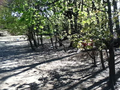
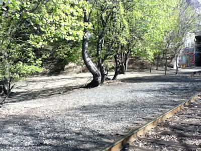
Here are some photos of the current use of the area between the BU Bridge and the BU Boathouse.  The photos were taken on April 30, 2016.  The dirt habitat has been artificially created by the DCR / its agents.  The crushed stone habitat has been the joint creation of the DCR and a group of irresponsible railroad workers who were very destructive, with clear consent of the DCR “manager.”  There are a lot of Charles River White Geese in the area nearest the BU Bridge.  They had been feeding on grass across the on ramp to Memorial Drive, but that was not consistent with the DCR / Cambridge starvation plans.  So the access to food was once again denied.


Much of this is FINAL WORK on the “remediation” of the BU Bridge repair project.  It clearly shows the level of lack of responsibility which can be expected to come out of the destruction of hundreds of trees in January.

You will note that the Charles River White Geese have been forced to nest in very precarious locations.  A major part of this need comes from the deliberate destruction of ground vegetation by the DCR and its friends / agents.  Some of the nesting to which they have been forced is between the Grand Junction and the BU Boathouse, the Wild Area which the relevant part of the destruction plans clearly call to be totally destroyed, by showing one undestroyed tree and nothing else where there are currently hundreds.  The destruction plan also could be calling for the destruction of all trees in the area where the J shaped highway would go, along with all trees on the river and next to the BU Bridge.

While the plan specifically calls for the destruction of an excellent tree at the on ramp, the omission of so many trees even on this side flags more proposed destruction.  A number of trees between the BU Boathouse and the Hyatt Regency on the river side were destroyed in spite of their not being spelled out for destruction in the destruction plans.  (See the YouTube video).  Cambridge and the DCR love to destroy trees.


There has been very major deliberate destruction of the area by the DCR as heartless animal abuse furthering the starvation imposed upon the Charles River White Geese by the Cambridge / DCR destruction at Magazine Beach in the 2000s.  The fact that the current plans of Cambridge and the DCR make the situation at Magazine Beach worse make the situation that much more scary.

The stated goal of the DCR is to kill off or drive away all resident animals, and the DCR, with the assistance of the City of Cambridge could care less about the 34 year residency of the Charles River White Geese, and their very great Tourist Appeal.

Of very clear interest was a comment by the DCR manager at a fake “public input” session that the DCR stands ready and willing to transfer control of Magazine Beach to Cambridge in accordance with the agreement which was part of the 2000s destruction.  Clearly, Cambridge wants to be able to blame the DCR for the ever increasing outrages and deny, deny, deny Cambridge’s very real joint planning involvement.

Sincerely, 


Robert J. La Trémouille
Individually, and as Chair
Friends of the White Geese

The letter,plus one photo, duplicates the photos published in my report posted at http://charlesriverwhitegeeseblog.blogspot.com/2016/05/charles-river-springtime-in-destroyed.html.  This report contains all the photos.  The reason for the prior omission was technical.  The original photo was "portrait."  The software reported it as "landscape."  So the tree would have been shown lying on its side.  I have since edited the photo to make it square which was allowed by the software.

Monday, May 02, 2016

Charles River, Springtime in the Destroyed Nesting Area of the Charles River White Geese

Charles River, Springtime in the Destroyed Nesting Area of the Charles River White Geese

1. General.
2. Visit.
3. Visit in Context.

1. General.

Our video on the destruction of Memorial Drive on the Charles River in January 2016 by the Massachusetts Department of Conservation and Recreation with the support of the City of Cambridge  is posted at https://youtu.be/h_u-woTPRJ8.

2. Visit.

Last Saturday, on April 30, 2016, I visited the Destroyed Nesting Area of the White Geese and looked at a recent, apparently complete “improvement” by the DCR and Cambridge.

It looks, in many ways, like a wasteland, less of a wasteland than the DCR and Cambridge created in January, but this is the FINAL PRODUCT.

Major work was done on the BU Bridge a few years back.  In the middle of the project, the legislature destroyed the then Metropolitan District Committee and replaced it by splitting its responsibilities between the Department of Transportation and the Department of Conservation and Recreation.  MassDOT got the bridges.  DCR got the riverbanks, along with the planners and managers.

The BU Bridge repair work was planned by DCR.  It included major destruction in the Destroyed Nesting Area which was totally unnecessary.  The area about 100 feet from the BU Bridge was needed for access.  But the DCR did additional destruction pointed into the DNA which was very much not necessary.

I found a lot of the Charles River White Geese in that area.  REMEMBER, much of this area has been “repaired” after the BU Bridge work.

Look at all the dirt.  The DCR planted a bunch of shrubs and simply let them die or survive.  If they had done what was intended, the “repaired” area would have been overgrown with excessively thick bushes, like the bushes on the banks of the Charles shown in the “Heartless Animal Abuse” portion of the video.  Some bushes survived and most died.  The DCR is very happy to have created a bunch of dirt where they promised bushes.

To make the repair project work, however, a 100 foot strip next to the BU Bridge was created that made sense to create for BU Bridge access.  The, as usual, lies of omission withheld mention that this formerly vibrant area was planned for dirt along most of its extent.

No grass, nothing to make the place livable.  Just dirt, and a lot of bushes which did not survive because, at least in part, the DCR did not care.  They had done their part.  They had made work for the contractors.  There was no more make work to brag about.  So they just let everything die and remain dirt.

The goal of the DCR is to kill off or drive away all resident animals.  The situation created is obvious and deliberate.

The Charles River White Geese are doing their best to make a living out of this outrage.

Here are photos of them from Saturday.


Heartless animal abuse.

ALL of the gravel, except near the railroad tracks, has been dumped there by the DCR and its friends (irresponsible railroad workers friendly to the DCR were particularly destructive).  The bare earth is overwhelmingly the creation of the DCR and its friends.  

I saw two visitors whom I have never seen before.  They were not there when I returned.  So I presume they are migratory.  On looking over the shots, I only see one photo, of one of the two, and, as photographed, it does not look that distinctive.  My memory is of a reddish color.  Perhaps my color rendering is not that good.

A lot of the Charles River White Geese are near the entrance.  Here is a photo of the entrance.


The Charles River White Geese have been getting through this starvation fence and eating under Memorial Drive.

The tangle with the barrel and its top is new.

The Charles River White Geese were hoping to get food, but food is being denied to them even more aggressively.

Heartless animal abuse.

The Starvation Wall at Magazine Beach (details in the video under Heartless Animal Abuse) was created to starve them.  The DCR found out that they were getting food.  So the DCR has created this additional Starvation device.


3. Visit in Context.

The photos in this section are taken from the video linked in Section 1.

The first photo places the Destroyed Nesting Area in context.

The area destroyed in January runs from the Destroyed Nesting Area on the left TO THE SECOND BRIDGE TO ITS RIGHT, an inconceivably large area in a major metropolitan community.

And it was destroyed BY THE Massachusetts DCR AND BY CAMBRIDGE, MA, USA.


Here are the destruction plans for the January outrage which apply to the area including the Destroyed Nesting Area (on the left) and the Wild Area (on the right).


At the far left is the BU Bridge.  At the top is Memorial Drive.  In the middle is the Grand Junction Railroad.  At the right is the Wild Area.

The Wild Area shows exactly one tree, and they say they are not destroying it.  But the Destroyed Nesting Area shows only five trees, one of which they say they are destroying.

The trees by the railroad tracks are also not shown.  That is scary, given the destructiveness of these terrible people, the reflexive cheerleading of the fake groups and the determination of the Cambridge City Council to have folks look at everything except the outrages inflicted by the City of Cambridge and the DCR.

A highly reasonable interpretation of the plans for the Wild Area is that every tree east of the railroad tracks and west of the BU Boathouse is doomed.  Even more scary is the omission of so many trees in the Destroyed Nesting Area.

The Cambridge City Council has its own destructive plans for the two areas.  Those are called by the euphemism of a Grand Junction bike highway.  Those destructive plans, as is the custom with outrageously destructive plans are kept as secret as possible while pablum is put out about how great the plans are.

In the photos in section 2 above, the BU Bridge repair “corrected area” is to the left.

I must apologize for an omission in the title in the video.

IT IS ALWAYS AN ERROR TO ASSUME “They would never stoop so low.”

The video in a later slide mentions the apparent destruction of the Wild Area because all those trees are not mentioned.

The video in this slide does not mention that THE ONLY TREES SHOWN in the Destroyed Nesting Area are the ones near Memorial Drive.  Is it intended to destroy all the rest?


Look at the true vileness achieved by Cambridge and the DCR as documented in the video.

IT IS ALWAYS AN ERROR TO ASSUME “They would never stoop so low.”