Saturday, May 09, 2015

Charles River Under Attack, Spring Photos

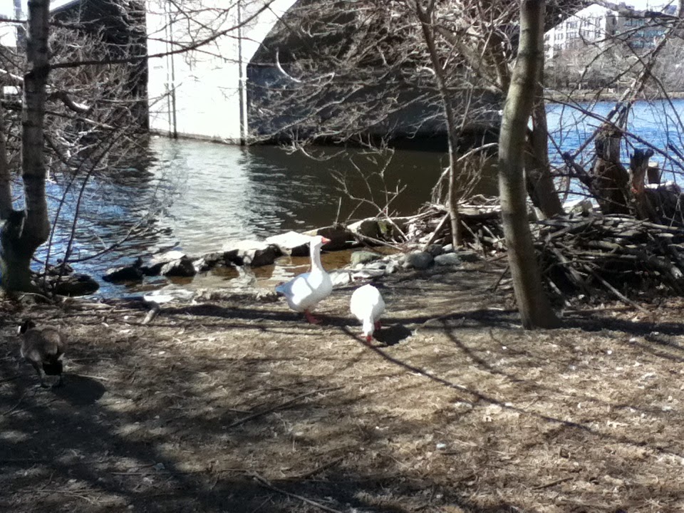
RE: Charles River Under Attack, Spring Photos

1. Threatened excellent tree, one of hundreds.
2. Destroyed nesting area, spring morning.
3. Two river shots.


The outrage at the Cambridge Common and my work on the possible Green Line A project combined with some computer oddities, so that I have not been able to pass on some photographs I took on April 29 at the destroyed, and threatened Nesting Area of the Charles River White Geese.

1. Threatened excellent tree, one of hundreds.


This tree is magnificent.  It is just east of the BU Bridge, hanging over the Destroyed Nesting Area.

This tree is one of the hundreds the fake neighborhood association is fighting to destroy by telling people to look at everything else.  That destruction is likely to include even more destruction in the Destroyed Nesting Area and ramping up of the abuse of the Charles River White Geese, 34 year, beloved residents of the BU Bridge area of the Charles River, beloved except by the folks spending the money.

The dirt is the remnants of the BU Bridge project, delivered by the Massachusetts Department of Transportation following plans of the Department of Conservation and Recreation.

The politics are that the DCR is truly vile and is in bed with the fake ground which calls itself a neighborhood assocation and lies that it is defending the Charles River.  This is a standard company union.  Fill a gap, lie that you are holier than thou and fight for exactly the opposite of what you claim to stand for.

Everything this vile group tells people not to look at, this vile group is fighting for.

When it put its “plans” up for public comment insofar as it did not lie through omission, the fake group’s SACCHARINE laced plans would have been defeated if they had been put up for a vote.  So its indulged in corrupt tactics and stole “support” through corrupt tactics for the SACCHARINE laced version of its plans.

This tree is temporarily living proof of just how vile Cambridge, its fake groups and their friends are.

Through corrupt tactics, they have working for destruction and destruction.

MassDOT is a breath of fresh air.  They are not perfect, and there is only so much of the determined vileness of Cambridge and its friends they can stand up, but they are a breath of fresh air in the stench which is Cambridge, its friends, and its fake groups.

Cambridge has shown on the Cambridge Common, the sort of outrage this reprehensible government considers normal.  It is silly to distinguish between Cambridge, the DCR and all the various lovely sounds which lack reality.

This tree is probably fatally condemned by this vile government and its friends, along with hundreds of others and along with further attacks on the ghetto to which the Charles River White Geese have been confined.

This tree is probably fatally condemned by this vile government and its friends, along with hundreds of others and along with further attacks on the ghetto to which the Charles River White Geese have been confined.

The key vote at the State House was Ch. 286, of the Acts of 2014, “Historic Parkways.”

Twenty million dollars.

2. Destroyed nesting area, spring morning.


This used to be lush vegetation.  The two patches of vegetation coming to life on the left and the bottom are the portions which were not destroyed by Cambridge’s friends.  There are signs on the right of each of these patches that nature is starting to heal itself, but nature will probably not be allowed to do so.

The much more visible, and falsely named Charles River “Conservancy” went through this place destroying ground vegetation.  And replacing ground vegetation with dirt.  This is what they call an improvement.  They clearly were acting as agents for the state bureaucrats and, through the state bureaucrats, the vile core of the City of Cambridge.

The fake Conservancy has been the front for Cambridge and its friends in the fight for further destruction of trees including, almost certainly, a direct attack on the Charles River White Geese’s ghetto where they have been confined without food since Cambridge / friends walled off Magazine Beach with invasive bushes to keep water uses away from the banks of the Charles River and to starve the Charles River White Geese.

More recently, rail workers WITH THE EXPLICIT PERMISSION / DIRECTION OF THE KEY MANAGER added to the destruction and dumped more crushed stone.  This highly paid fraud has spent at least a decade lying that he has no intention to harm the Charles River White Geese.

And the publicly announced plans being considered by the Cambridge City Council for destruction here would only be a start on the $20 million outrage supported by the State House in 2014.

3. Two river shots.


The destroyed nesting area is to the left.  Once again, the waterfront was lushly vegetated until Cambridge’s friends destroyed the vegetation.

The structure in the middle is the railroad bridge on the Grand Junction Railroad.  This is the future location of an off ramp from the Massachusetts Turnpike (I90) to Cambridge, if the powers that be get their way.  This off ramp is the key reason behind the destruction of those hundreds of trees.  Cambridge and its friends are rearranging Memorial Drive to take the traffic.

Just beyond the bridge on the left is an adjacent wild area.  Cambridge / the bureaucrats / the CRC destroyed this area for resident animals as part of the Destroyed Nesting Area destruction.

Beyond the trees visible on the left is a yellow building.  That is Boston University’s Boston boathouse.

The Charles River White Geese spent the worst days of a very bad winter on the Charles River just before this boathouse.  I never saw the river fully frozen.


The Destroyed Nesting Area / the Charles River pretty close to the BU Bridge.  The diagonal area at the bottom left is a portion of the BU Bridge.

Monday, May 04, 2015

Charles River: Green Line A Rapid Transit for Olympics — Harvard Square

Charles River: Green Line A Rapid Transit for Olympics — Harvard Square

1. Introduction.
2. General Analysis.
3. Harvard Station connection — Platform alternatives.
a. General.
b. Station S1 at the existing Harvard Station passenger area.
c. Station S2, next to the lower busway.
d. Station S3, under Eliot Street.
4. Harvard Station connection — Actual route alternatives.
a. Route 1, through JFK Park with general comments.
b. Route 2, through JFK Park with a sixth Green Line A Station, with general comments.
c. Route 3, under Eliot and JFK Streets, without or without a sixth Green Line A station.
d. Routes 4 and 5.  Deep bore under the JFK School with or without the sixth Green Line A station.
5. Conclusion.


1. Introduction.

This is the third report in a series on possible Rapid Transit support for the Boston 2024 Olympics, to help the Boston Allston neighborhood, and to receive repairs to  Charles River damage inflicted by Cambridge, MA and its friends.

The two prior reports are posted at:

General analysis:  http://charlesriverwhitegeeseblog.blogspot.com/2015/04/charles-river-new-green-line-ideal-for.html.

BU Bridge end of Green Line A:  http://charlesriverwhitegeeseblog.blogspot.com/2015/04/charles-river-green-line-boston.html

2. General Analysis.

Here is a map of the future home of Harvard Medical School, sometime in the 21st Century, maybe.  A former rail yard has been moved to Worcester, leaving most of the site empty.  The site is larger than Boston’s Back Bay neighborhood.  Superimposed on the plan is a proposed Green Line A spur to grant access to the area.

The site is located to the east of Cambridge Street in Boston’s Allston Neighborhood, with residential and industrial uses on the southern end and Harvard’s ongoing expansion on the northern end.  It is south of (below) the Charles River and Soldiers Field Road.  To the east of the location (right) on its south is a residential part of the Allston neighborhood and, on its north, the western end of the Boston University campus.  The site’s southern end is close to the Allston Village shopping area.


The Massachusetts Department of Transportation is in the process of greatly decreasing the land occupied by I90 / Massachusetts Turnpike’s exit to Cambridge and the Allston neighborhood of Boston.

There are a number of planned locations for Olympics activities near this site, as analyzed in the second report.  The turnpike rearrangement will be done with plenty of time to use this area for the Olympics.

There are major plans for South Boston / Dorchester in areas which are currently in use, and the people using those areas do not want to lose their property.

This area in Allston is empty, massive and will be ready for use in time to prepare for the Olympics.  The Mass. Pike rearrangement gives vehicular access.  Parking structures could be constructed which would be underutilized until Harvard decides to go forward with its Medical School relocation.  Housing could be constructed at the bottom, narrow point of the triangle which could be used for rentals until Harvard is ready to use it. The very clear and major benefit to Harvard gives Harvard incentive, to subsidize the effort financially.

Cambridge influenced “activists” are yelling anti-environment at the Olympics.  The reality is that  the Olympics folks want to undo part of the outrages inflicted on the Charles River by Cambridge and its friends.  Environmental improvements are commonly called exactly the opposite of reality by Cambridge controlled folks.

The Olympics people sound friendly to me so far and I can common cause in undoing much more of Cambridge / friends destructive ideas.  In particular, I would want to help their destruction of Cambridge’s outrage at the Magazine Beach playing fields.

The Olympics folks need public transportation.  A new Green Line spur running from the Green Line at the BU Bridge area in Boston through their planned sites and Harvard’s Planned Medical School and then to the Red Line at Harvard would be ideal for their needs, as shown on the map.  The general analysis is linked above.  The analysis of the BU Bridge area, which benefits the Charles River White Geese and other residents of the Charles River is in the second link.

Below is a detailed plan with maps on how to make the connection to Harvard Station.  I will follow up with relevant photographs.  The analysis is based on a Cambridge map of the area.

3. Harvard Station connection — Platform alternatives.

a. General.

Here is a map of the area approaching Harvard Station.

The key to the connection is a tunnel which runs from Harvard Station most of the way to the Charles River.  This tunnel was used for 70 years or so to give access from the then terminus of the Red Line at Harvard Square to a former Red Line yard which was located near the river.

There is now no physical impediment whatsoever to using that tunnel.  You just need to connect to it from the Boston side and make rearrangements in Harvard Station which are less than massive, and definitely much less massive than the Harvard proposal for public transportation to their future Medical School location.


The broken line in the map represents the existing tunnel.  It is two stories below ground.  Location is approximate.

The tunnel ends slightly to the left and down of the line which is visible.  Before Harvard constructed the building between the tunnel and Eliot Street, the tunnel was visible in the wall supporting a pathway connecting Eliot Street to the JFK Park, two stories above the tunnel.

On the upper right is a black marked island bearing the letter T.  This is Harvard Square.  The T mark is the area housing the Harvard Station complex, including stairs, escalators and an elevator to the street two floors above the pedestrian plaza of Harvard Station.

I have marked “S1" next to the station plaza.  This is an ideal location for the Harvard Station terminus of a Green Line A.  Going to the left, there are “S2" and “S3" markings for two alternate locations, all two stories below ground.

b. Station S1 at the existing Harvard Station passenger area.

Roughly at the point of the “T” are two stories of stairs and escalators.  The access starts at ground level on the left.  They move to the right to a mezzanine, reverse direction and end two stories below the point where they started.

Looking down on the map, below/south, you see on the station level a Dunkin Donuts strip line shop.  That shoo is between the public area and the tunnel.  All that is necessary for access to the tunnel is to move the coffee shop closer to the stairs and further to the left, so that people can access the tunnel by going around the shop and waiting for the trains behind the shop.  A bank of telephones could easily be moved to the other side of the stairs / escalators, and the wall can be removed as far over as is needed for access.

The standard MBTA fare machines can be constructed in a line at the beginning of the Coffee Shop with appropriate barriers.

The one part of the rearrangement that requires work is the elevator for handicapped access.  That elevator would have to be moved to the north side of the mezzanine.  The elevator could, on relocation, grant direct access to the area on the far side of the stairs / escalators and could also grant access to the mezzanine which is now not possible for the handicapped.  Moving the donut shop to the mezzanine could be an ideal rearrangement.  The mezzanine was designed for sale of passes at that location.  Other relatively small uses could remain on the mezzanine or be moved do to the passenger plaza on the far side of the stairs near the relocated elevator, among other possibilities.

This arrangement is a prime location for the Green Line A terminus.  The big defects is moving the elevator.

c. Station S2, next to the lower busway.

There is a two level busway above the tunnel as you look at the map.  The two run parallel in the block between the two streets (Palmer and Brattle) to the left of the T station.  Two alternate station locations “S2" and “S3" are left and right of the second street, Brattle Street.  The first block from the T location is part of Brattle Street.

All that separates the Green Line A tunnel and the LOWER of the two busways is a non load supporting wall.  After Brattle Street side street, the bus tunnels run under the building above the S3 marking and connect to the next street, Mt. Auburn Street.

There is an elevator from the ground level to the UPPER of the two busways next to Brattle Street.  It is located just to the right of the Brattle Street side street.

All that is necessary to create a Green Line Terminus next to the EXISTING platform of the LOWER of the two busways is to tear down the non load supporting wall.  The problem with this location is the interaction with the busway and the busstops.

It would be necessary to move the existing bus stops to the right, in order to close off an area at the Station S2 platform for fare machine access..  The bus stops currently occupy more horizontal space than do comparable bus waiting facilities.  Moving the bus stops would probably be feasible.  It would make the operation tighter, but not at all unusual.  A wall / open fence could be created separating the busway from the waiting area for Green Line A.

An existing stair from the Brattle Street and its side street grants access to the busways.  Through the upper busway, it connects to the main station and the Red Line.  This stair would provide direct access to station S2.  Foot traffic to the lower busway currently uses that staircase. Continued access to the lower buswaywould be no big thing.  Just go down the ramp from the upper busway, and you are at the lower busway.  Given the need to move the bus stops, access would be very close to identical to the current situation.

The only defect in station S2 is the need to crowd the bus stations.  Plus, it is further from the rest of the operation that in station S1.  I think that station S2 is the best possible of the three locations.  Its access from the main station complex is pretty much identical to the Red Line access.

There is a very big advantage in the removal of the need to rearrange the main part of the station by moving the elevator.

Station S2 is definitely feasible.

d. Station S3, under Eliot Street.

Station S3 would involve constructing the Green Line A platform two stories down under Elliot Street between the existing building and the triangular piece of open space.

Underground access would be simple.  Just tear down part of the non load supporting wall between the Green Line A tunnel and the lower busway passenger waiting area, and turn the existing tunnel into pedestrian access.  The Green Line A tunnel end would end at Station S3's end, at the pedestrian access on left side of the Brattle Street side street.

Ground access would be constructed from the triangular open space or the large sidewalk below / south of it, along with a handicapped elevator.

Station S3 would be easy for construction of the usual toll control.

The disadvantages to Station S3 are that it is the furthest from the main station, and that it would involve very real construction with related surface damage and interference during construction.

Waiting space would have to be to the right of the tunnel because the tunnel is right next to the building.

4. Harvard Station connection — Actual route alternatives.

I will take these one by one.  Route 1 is the preferred but there are advantages to the other routes.

We will start with Map B showing Routes 1 and 2.


a. Route 1, through JFK Park with general comments.

John F. Kennedy Memorial Park seems to have been designed with this route in mind.

There would be NO DESTRUCTION OF TREES on the Cambridge side and any destruction on the Boston / Allston side would be of very young trees if at all.

This would be a matter of digging up under the pathway to JFK park from Eliot Street.  Then connect the existing tunnel to a new tunnel going south.

Construction under the path could only hold one track.  Construction could be accomplished north / above the path under Eliot and Brattle Streets, creating double trackage to but not including Station S1, for a lesser distance to the other station alternatives.

Double tracking the terminus at Station S2 probably would not be possible.  It would require a platform between the two tracks.  There is not enough room down there for the busway with its existing waiting area, two tracks and an additional area between the tracks for the new platform.

Station S3 would definitely allow that sort of track doubling, and would allow loading / unloading on alternate tracks in the manner which is currently done at Alewife Station on the Red Line.  This capability is a very major advantage to the Station S3 location.

Cut and cover construction to cross the Charles River would involve damming off the Charles River first to one side and building and then to the other side and building.  The connection to North Harvard Street would be at the northeast corner of the Harvard Stadium complex.  If it is needed to go near the nearest building, that is where young trees would be destroyed.  Then under North Harvard Street and proceed to Harvard Stadium / Harvard Business School stop located wherever convenient.  Harvard’s current athletic facilities south of Harvard Business School should have vehicle storage located under it, and would be ideal for deep bore staging during construction.

The time factor for cut and cover construction under the Charles River probably would prevent opening in time for the Olympics.

Additionally , getting under Soldiers Field Road at this point could be dicy with cut and cover.  The practical way to do this would be digging very deep to go under.

The minute you are digging very deep to get under Soldiers Field Road, you might as well do the entire construction very deep using “deep bore” construction.

In alternative 1, deep bore would start almost immediately upon contact with the existing Green Line A tunnel under the pathway, and go down, with work access from the very large existing treeless part of the JFK Park.

The exact Harvard Stadium / Business School Station location would be determined taking in mind the slope calculation of the Green Line A tunnel.

The Green Line A route would be double track until you arrive at the existing pathway area between the Charles Hotel and the JFK School.  At that point, under JFK park space, trains would wait for trains ahead of them to unload / load.  Plus space should be left under JFK Park for some storage. Larger storage should be constructede under the Harvard athletic facilities south of Harvard Business School.  Additional layover would be constructed by cut and cover under Eliot Street (which goes as far north as the Brattle Street turn).

Trains would wait in the layover spots for trains to unload and load in the station if the station is a one track stub, or if there is a backup problem.

b. Route 2, through JFK Park with a sixth Green Line A Station, with general comments.

There is a very large intersection at JFK Street / the Anderson Bridge and Memorial Drive.  This could hold a sixth station giving access to JFK Park, south Harvard Square, and to this part of Harvard University, plus to Charles River uses.

Route 2 would connect to the existing tunnel as would Route 1, and then go cut and cover or deep bore to the new JFK Station.  From there cut and cover could be done on either side of the Anderson Bridge, or deep bore under the Anderson Bridge.

Cut and cover would involve tree destruction.  Deep bore would minimize or eliminate it.

c. Route 3, under Eliot and JFK Streets, without or without a sixth Green Line A station.


Route 3 would connect to the existing tunnel under Eliot Street, then turn with Eliot Street, and turn into JFK Street, to the Anderson Bridge area.

It would definitely be possible to do cut and cover along this route, with the three alternative Charles River crossings previously discussed.  This route would allow double tracks up to or including the stations as mentioned above.  Because of the double track possibility, and all other things equal, this route would be preferable to routes 2 and 1.  Construction would clearly be highly disruptive and expensive, obviously a disadvantage.

Construction could be moved to deep bore pretty rapidly if deep bore for routes 4 and 5 is not possible because you cannot get under the JFK School fast enough.

This route allows for but does not require the sixth new rapid transit station under the very large intersection at Memorial Drive and JFK Street, which could be used for access to this part of Harvard, of Harvard Square, and to JFK Park.

d. Routes 4 and 5.  Deep bore under the JFK School with or without the sixth Green Line A station.


Deep bore under the Kennedy School of Government, either to the sixth station or separate from it.  The tunnel starts two stories below ground at the existing tunnel.  Construction would proceed under Eliot Street to the JFK School building next to the connecting path.  The new tunnel would have to be far enough down to minimize impact on the JFK School.

Double tracks would be possible all the way to the Harvard Statoin station alternatives.  Station S3 would probably prevent getting deep enough to go under the JFK School.

5. Conclusion.

I would think that Station S2 with layover under Eliot Street and deep bore route 1 would be the preferred alternative.  It is the least disruptive and probably the least expensive alternative.  Eliot Street layover would be needed for the deep bore construction route, and probably would be preferred, in addition to JFK Park layover for the cut and cover alternative.

This analysis replaces portions of my earlier analysis.  I have thought things over more deeply.

Photos of existing conditions will follow.

Tuesday, April 28, 2015

Updating of “What We Can Do to Help on the Charles River?”

Updating of “What We Can Do to Help on the Charles River?”

This information is linked near the top of the blog.

I have just updated it with reorganization.

The information includes very brief comment on the outrage which involves the Charles River and related outrages by the City of Cambridge and its friends.

The information provides a lot of ideas on “What We Can Do to Help on the Charles River?”

It is posted at http://charlesriverwhitegeeseblog.blogspot.com/2012/03/what-can-we-do-to-help-on-charles-river.html, in addition to the link at the top of the blog.


Saturday, April 25, 2015

Charles River: Charles River: 10 Bad City Councilors on a 9 Member Cambridge, MA, USA City Council

Charles River:  Charles River:  10 Bad City Councilors on a 9 Member Cambridge, MA, USA City Council.

1. 10 Bad City Councilors on a 9 member City Council.
2. Cambridge Common.
3. Alewife.
4. Malvina Monteiro.
5. Charles River.
6. Overview.
7. Summary.


1. 10 Bad City Councilors on a 9 member City Council.

Said with knowledge of reality.

2. Cambridge Common.

I have just reported on the outrage on the City Council’s destruction of the Cambridge Common.

I informed the current Cambridge City Council of their plans for destruction of the Cambridge Common, and and I objected to their plans for destruction of the Cambridge Common.

I included photos of the threatened outrage.

That report is posted at http://youtu.be/ FgQ9ojVuMxM.  Photos of their achievement are posted at http://charlesriverwhitegeeseblog.blogspot.com/2015/04/charles-river-cambridge-common-outrage_17.html.

About a month before the destruction, the current Cambridge City Council (with appropriate euphemisms) sent an order to the Cambridge City Manager wondering why the trees had not been destroyed and encouraging him to destroy them as fast as possible.  No objections to the order.

I note from the Winters blog that he anticipates last term City Councilor Minka Y. vanBeuzecom to be seeking reelection after a term of forced absence by the voters.

VanBeuzecom is one of the standard Cambridge liars claiming to be environmental saints.  Her house signs contain a graphic lying of environmentalism.  She clearly protects the environment based on Cambridge's secret definition in which “environmentalism” is defined as the protection of that part of the environment which is not currently being destroyed by the City of Cambridge.

VanBeauzecom voted for the funds for destruction of the Cambridge Common.  Her explanation was that the Development Department told her it was ok.

3. Alewife.

This includes multiple destruction of the environment at Alewife, a lot in compliance with irresponsible zoning under the supervision of the Cambridge Council.  This includes the destruction of 3.4 acres of Alewife behind 165 CambridgePark Drive by the City of Cambridge and its friends, with the strong likelihood of total destruction coming.

During vanBeuzecom’s term of office, I sat through a presentation associated with her in which she bragged of environmental enlightenment of the City of Cambridge at Alewife.  Under the Cambridge definition of “environmentalism,” she was bragging about protection of the environment except for that part of the environment being destroyed by the City of Cambridge.

I directly questioned her about Cambridge’s destruction of those 3.4 acres of irreplaceable woodlands in the Alewife reservation behind 165 CambridgePark Drive.  VanBeuzecom had no problem with the destruction of those 3.4 acres.

VanBeuzekom has served as a poster girl for the fake “protective” group fighting for destruction at Alewife while, of course, ignoring the destruction they are fighting for.

But vanBeuzekom loves to brag on Cambridge’s enlightenment at Alewife.

4. Malvina Monteiro.

This follows on the outrage of the destruction of the life of Malvina Monteiro.

Monteiro was a black Cape Verdean department head.  Monteiro had the nerve to believe the non stop claims of sainthood by the Cambridge City Council.  Monteiro had the nerve to file a women’s rights complaint alleging bias in pay because she was a woman.

Three levels of court STRONGLY condemned the then Cambridge City Manager, Robert Healy for this outrage.  Exactly ZERO members of the Cambridge City Council were in any way concerned about the outrage.  Exactly ZERO attempted to implement the very strong court communications and fire Healy for Malfeasance in Office.  He retired with honor.

The Cambridge City Council even named the Police Station after this person.

Healy committed “reprehensible” behavior.  Healy had presented about him “ample evidence of . . . outrageous misbehavior.”

These quotes are from the trial judge’s formal opinion and the Appeals Court Panel’s non formal formal opinion.  The trial jury awarded Monteiro $1.1 million real damages and $3.5 million PENAL damages, to express their contempt for the destruction of the life of Malvina Monteiro by Robert Healy.

This blog has fully quoted these two opinions.  The opinions are readily available from links on the home page of this blog.

All of the five currently sitting Cambridge City Councilors who have more than two years experience were part of this outrage.

5. Charles River.

This follows on the so many outrages on the Charles River.

Just to pick one, a vote that stands out is the vote of $20 million by the State House to destroy hundreds of excellent trees and animal habitat between the BU Bridge and the Longfellow Bridge, including the destroyed nesting area where the Charles River White Geese are being deliberately starved by Cambridge and its friends.  Massachusetts Ch. 286 of the Acts of 2014, “Historic Parkways”

My communication of DETAILED destruction plans to the current Cambridge City Council is posted at http://charlesriverwhitegeeseblog.blogspot.com/2014/04/tree-destruction-plans-charles-river.html.  They claim “neutrality” which translates as a wink and a nod, especially when viewed in light of their reprehensible record.

They are working on so many other outrages and have voted for so many other outrages.

Among other things, a unanimous Cambridge City Council, including vanBeuzekom, voted for “underpasses” for the three bridges after the BU Bridge on the Charles River.

The responsible state agency, the Massachusetts Department of Transportation, has condemned this proposal as environmentally destructive and wasteful of state money.

The fraudulently named Charles River “Conservancy” has called the destruction supported by vanBeauzecom and company something which includes the outrage in Ch. 286 of the Acts of 2014, “Historic Parkways.”  CRC fought for that destruction using this argument.

6. Overview.

I really cannot go into the massive tome which can be created.

The outrage on the Cambridge Common combined with the ongoing AND ACCELERATING outrage on the Charles River.

This disqualifies the current nine incumbents from being considered anything other than vile.

So the issue is other past city councilors who might be running.

Four councilors were not reelected in the last election.  Two, a current state representative and Davis, stood out as the most environmentally destructive members.  The current state representative did not seek reelection after being coronated for higher office.

Davis ran for more than a decade under the lie of being an “environmentalist” (under the Cambridge pols’ secret definition of :environmentalism,” secrecy of the definition never being mentioned, of course).  She did not seek reelection.  Good riddance.

That leaves vanBeauzecom and a Black gay man.

The Black gay man was part of the part of the accelerating environmental outrage.  He was part of the Monteiro outrage.  One councilor was fired by the voters, probably over Monteiro, in the prior election.  Monteiro was probably part of an accumulation of bad achievement by the Black gay councilor that resulted in his firing.

The Black gay councilor is not listed as a candidate by Winters.  He has apparently sold his house on Harvard Street.  Another good riddance.

VanBeuzecom.  Outrage on the Cambridge Common.  Outrage on the Charles River.  Outrage at Alewife.

VanBeuzecom clearly qualifies as the tenth bad city councilor.  She makes things worse because her lies of environmentalism make her fighting for votes that could go to people who are meaningfully pro environment.

7. Summary.

Ten bad city councilors fighting for nine city council seats in a truly vile political world.

Monday, April 20, 2015

Charles River: Cambridge Common and Destruction on the Charles River part of one sickness.

Charles River: Cambridge Common and Destruction on the Charles River part of one sickness.

1. Photos from April 19, 2015.
2. The Charles River and the Cambridge Common are both part of One Big Outrage.
3. And if you do not like it, look at what the Cambridge City Manager did to Malvina Monteiro with the blessing of silence by a City Council who somehow could see no reason to fire Robert Healy.


1. Photos from April 19, 2015.

Photos from my visit to the Charles River White Geese.

They are doing their best and preparing for nesting season in a formerly lush area almost all of whom’s ground vegetation has been ruthlessly destroyed by the bureaucrats and their agents, with Cambridge and the bureaucrats working to make things worse.

The bureaucrats got blessing by the State House last year for $20 million worth of destruction of hundreds of trees and of animal habitat in this part of the Charles River.

Much more to come, especially if the nine vile Cambridge City Councilors go forward with plans for a new highway in this area.


2. The Charles River and the Cambridge Common are both part of One Big Outrage.

My last several reports have presented the outrageous destruction of the Cambridge Common by the City of Cambridge using state moneys, by very clear support on the nine environmentally reprehensible members of the Cambridge City Council.

The most recent report is posted at:  http://charlesriverwhitegeeseblog.blogspot.com/2015/04/charles-river-cambridge-common-outrage_17.html

I have gotten some nice emails of support and praise, and I thank you folks for your comments.

The vileness of the City of Cambridge is something that the fake groups run around lying about.

The fake groups do a non stop pitch that vile behavior is something to praise the City of Cambridge about.

I visited the 34 year resident gaggle of the Charles River White Geese on Sunday, April 19, 2015.  They are being deliberately starved by Cambridge and its friends.

They have been confined in a ghetto that was lush with vegetation.  The vegetation was destroyed by multiple actions all linkable to the vile bureaucrats in the state bureaucracy who lie that they are defending the environment of the Charles River.

The dirt in these photos was artificially created from excellent vegetation by multiple outrages which are part of the same vile pattern as the destruction of the Cambridge Common.

These artificially created outrages differ in no meaningful way from man destroying our world throughout our world, except that the Cambridge Pols lie that they are the good guys.  And if you do not believe them, look at what they did to Malvina Monteiro, and look at what they are doing to the Charles River White Geese, with much, much worse to come if they have their way.

And their friends are yelling at the Olympics.  The Olympics organizer are anti-environment.  The Olympics organizers want to destroy the starvation wall which prevents access to grass where the Charles River White Geese have fed for most of the past 34 years, and they have poisoned that grass.

What do the fake groups say?  They say do not look at the outrages.  They are fighting for massive destruction through company union techniques:

a. Do not look at the horrors being planned AND ACCOMPLISHED by the City of Cambridge and its friends.

b. Look at the supposed beauty they are promising with the usual lies of omissions of the important destruction: expansion of the poisons, continuation of the starvation wall, destruction of the little guys parking lot, implementation of a highway which is part of the destruction of hundreds of excellent trees they are fighting for by telling responsible people not to look at so many outrages being fought for by the vile Cambridge and its friends.

The local fake group did put their plans to a public meeting, AND LOST, based on negative comment from the floor.

The public meeting was not pleased.

So the fake group implemented blatant corruption.

They closed the meeting and deferred the vote from that January 2014 meeting to the February 2014 meeting which they conducted on April 23, 2014.  Then, in a meeting blatantly less publicized than the honest meeting they lost in, they went through an outrageous and blatantly false vote.  That particularly fake vote forms the basis for continued lies that their continued attacks on the Charles River have any claim to be responsible behavior.

The propaganda show presented lies about the Charles River White Geese, and showed the fake group’s public support for the bureaucracy’s goal of killing off or driving away all animals who are resident on the Charles River basin.


The short of it?  Just more sickos destroying the only world we have to live in while lying of their own sainthood.

3. And if you do not like it, look at what the Cambridge City Manager did to Malvina Monteiro with the blessing of silence by a City Council who somehow could see no reason to fire Robert Healy.

Too often, when independent outsiders look at the City of Cambridge, they have the sort of opinion expressed by jury, judge and appeals court panel in Monteiro v. Cambridge.

The court decisions are posted on this blog at:

Superior Court:  http://charlesriverwhitegeeseblog.blogspot.com/2009/04/judge-issues-decision-denying.html

Appeals Court Panel:  http://charlesriverwhitegeeseblog.blogspot.com/2011/08/appeals-court-decision-in-monteiro.html

The jury had one tool to express its well found contempt: multiple penal damages.

This was a case in which a department head, a black Cape Verdean woman, had the nerve to listen to the Cambridge pols and behave accordingly.  She filed a civil rights / women’s rights complaint alleging she was being discriminated against by the City of Cambridge by being paid less than men would be paid.

Robert Healy, the middle of the three person City Manager regency, destroyed her life by firing her in retaliation.

The jury awarded her $1.1 million real damages, and $3.5 penal damages.  The penal damages are intended to communicate contempt for the City of Cambridge’s vile behavior.  They exceed the normal maximum percentage for such awards.

The trial judge spent a year writing her opinion.  It can be summed up in one word: “reprehensible.”

The appeal courts panel refused to dignify Cambridge’s appeal with a formal opinion.  The non formal formal opinion stated in relevant part: “ample evidence of . . . outrageous misbehavior.”

The Cambridge City Council saw nothing wrong with Healy’s behavior.  Exactly ZERO members of the then City Council sought to implement three levels of court condemnation by giving Healy a firing for malfeasance in office.

Healy and the Cambridge City Council clearly showed how decent behavior is treated in Cambridge, MA, USA, if that decent behavior deviates from the non stop lies of holiness.

Destroying a woman’s life for filing a women’s right complaint is considered normal behavior by the fake groups and by the Cambridge pols.

Friday, April 17, 2015

Charles River — Cambridge Common Outrage in Context

Charles River — Cambridge Common Outrage in Context

1. Introduction.

The most important thing to remember about the Cambridge Common Outrage is that it is a pittance in comparison to what Cambridge and its friends are working to destroy on the Charles River.

The second most important thing is that the real rotters are clearly exposed.  The nine (out of nine) environmentally vile members of the Cambridge City Council have nobody to hide behind, no lies that even the most determinedly stupid will believe.

No fake groups running around lying that they are defending and telling folks not to look at the coming outrage.  None of their belligerently corrupt tactics.

The Cambridge Common is squarely on the shoulders of the nine (out of nine) environmentally vile members of the Cambridge City Council.

2. What it looks like on the City of Cambridge’s map.

I have been able to find an official Cambridge map of the Harvard Square area.  I have cropped it to show Harvard Square proper and the destroyed part of the Cambridge Common, realizing that more destruction, like on Memorial Drive, is likely coming.

I have marked the map 1 through 6 to better localize this particularly

I am going to reprint photos and align the photos to the area on the map.  The most important thing to notice, however, is that the key area of destruction is the most publicly prominent part of the Cambridge Common, the entrance cacing Harvard Square.  On the map, that is point number 5.

This is my standard before picture.  It is taken from area number 5.  The pathway straight ahead is that pathway running from area 5, the entrance, to area 6, the area around the monument.  To the right is area 1 and Massachusetts Avenue.  To the left is area 3 and Garden Street.  Just barely visible to the left is the smaller monument which appears in many pictures.


This is my now current after picture.  The monument in area 6 is now highly visible.  It was formerly obscured by, horrors, excellent trees.  To the right is area 1.  Visible through area 1, NOW, is a Harvard building which formerly housed the JFK School of Government.

Notice the lamppost to the right and the now destroyed second tree.

There used to be trees straight ahead in area 4, on the corner and to the left, directly in front of the monument.  The photo is ahead of the remnants of the tree to the left in the before picture.


Here is the before picture and the couple a bit further ahead.

Look at all the trees which have been destroyed.


Closeup of some of the destroyed trees in area 3.  You can see cones but not all the outrage is marked by cones.


Repeating the map.


Looking from area 4 through area 2 at Harvard’s former JFK School.  You can see one destroyed tree straight ahead.  and to its right, one of the trees on the area 2 side which lined the entry path.  There is a cone to the far right and, to the left of the lamppost, what appears to be a stump.


Panning toward Garden Street through area 3 is the smaller monument.

To the left of the not destroyed tree is a stump without a cone and there appears to be a cone further over.  To the far left may be another destroyed tree.


Area 4, Garden Street to the right.  Area 5, the entrance, straight ahead.  The cone visible above the monument to its right is probably the destroyed first tree to the original left of the path, right at the entrance to the Cambridge Common.


This is from area 6, the main circle around the big monument.  An excellent tree destroyed straight ahead.  I am not certain what the nearer destruction cone denotes.


Giving you the original before picture again.


This is the opposite view of the before picture.  It is clear that ALL the trees lining that path have been savagely destroyed and the tree which was in the middle of area 4.  The church in the background is on the other side of the Old Burial Ground (map, below).  This was hidden before the outrage.  Look at the distance on that map.


Looking across the central plaza, you see Garden Street on the other side of three destruction cones.  The tall Harvard School of Education shows on the map.  This is Appian Way.

Panning further back, you are looking through the point on the map.  “Cambridge Common” is marked over part of this destruction area.

Two destruction cones are straight ahead, 1 stump without a destruction cone, and there is another destruction cone to the right.


Panning back to the Harvard Square Entrance (5) (on left), you can see a minimum of four destruction cones in areas 3 and 4.


Photo of the destroyed tree at the beginning, near area 5, in area 1.  The excellent tree to the right is almost certainly marked for death.


From outside the entrance.  The first two trees on the right clearly destroyed, area 1.  Everything clearly destroyed on the left.


And these folks are targeting the Charles River, lying of environmental sainthood.

Wednesday, April 15, 2015

Charles River — Cambridge Common Outrage, PART 2

Charles River — Cambridge Common Outrage, PART 2

On April 12, 2015, I forwarded my photos of the outrage inflicted on the Cambridge Common by nine environmentally vile Cambridge City Councilors.  This follows on the Cambridge City Council and friends destruction of 3.4 plus acres of the Alewife reservation, and the ongoing and impending outrages by the Cambridge City Council and its friends on the Charles River.

Key in all this is the massive organization in Cambridge lying of “concern” and implementing the exact opposite with non stop holier than thou lies.

Key on the Charles River is the fake group with its belligerently corrupt tactics and no meaningful support for the outrages they are TRULY fighting for in spite of loud proclamations to the contrary.

On looking at the report on Sunday, I regretted not providing a blow by blow description of the vileness.  Please note that trees without protection could be destroyed yet.

So, I am going back on selected pictures and will give you a blow by blow.  If you want the full package, please look at the blog report at:  http://charlesriverwhitegeeseblog.blogspot.com/2015/04/charles-river-cambridge-common-outrage.html.

First are the before and after pictures:


On this after picture, clearly, there have been a massive number of trees destroyed.  I am just looking at stuff I can point out in this picture.

Looking at the curve to the couples' left, I would say that they are standing to the right of the tree shown there, if it has not been destroyed.

See the lamp post to their right in both pictures.  The excellent tree behind the lamppost is one of many which has been destroyed by the vile nine.

Here is a photograph of the three closer to the plaza.


The excellent tree which was straight ahead has been destroyed (cone).  That was blocked by his body in the first photo.  To the left of the undestroyed tree left of that destruction, I can see three cone.


Here is a view from slightly to the left.  One of the excellent trees in the before picture is now a cone.  The one we just looked at can be seen straight ahead and to the right.  


The Harvard building in the background is on the opposite side of the intersection of Massachusetts Avenue and Cambridge Street.  It is the former JFK School of Government.  I am not certain as to its current use.  The jogger is on a path on the Cambridge Common destruction zone.

Note the lamppost to the left of the cone in the rear.  I would think that this was the second tree visible in the before picture, and that the stump on the far left was the third tree in the before picture.


Above, panning to the left toward Garden Street.  To the left of the not destroyed tree is a stump without out a cone and there appears to be a cone a bit further over.  To the far left may be yet another destroyed tree.


Here is another view of the same monument.  Straight ahead is the entrance from Harvard Square.  You can see a cone denoting destruction above the monument to its right.


Another angle of the same monument, from the circle around the main monument.  Two destruction cones.

Below is the obverse view of the before picture, from the central area of this part of the Cambridge Common.  In the back is the entrance to the park from which the before picture was taken.  All the trees (three) to the left of the before picture have been destroyed.  There is another tree in the middle without a cone.  Look for more at your convenience.  

True devastation of the entrance from Harvard square.  The steeple in the background is of the nearest church in Harvard Square to this outrage.


Panning the camera toward Garden Street from the central circle.  There are three destruction cones, at minimum visible.  Please excuse the variation in exposure.  I am using an iPod Touch, with a primitive camera.  Before the destruction, I did not have to worry about over exposure.  The tall building is Harvard's School of Education.


Panning further back (west) on Garden Street.  Two destruction cones.  One stump in the middle without a destruction cone, and another destruction cone visible to the right.


Panning back to the Harvard Square entrance (on left), I see a minimum of four destruction cones.


Getting another angle to the right of the original before photo.

Note all the protected trees and the excellent tree at the far right without protection.

It probably has been destroyed now.

I see a lot of other trees without protections.  Those are why I started in my last report showing unprotected trees.


There is more coming here.

There are vast numbers of targeted trees that the fake group is fighting to destroy on the Charles River.