Enough said, May 23, 2013 edition.
The Cambridge Chronicle, in recent months, has had problems publicizing reality when it comes to the ongoing environmental destructiveness of the Cambridge Machine and its cynical con games. I think the editor took offense against me when I referred to the leader of the fake group fighting for destruction of Alewife as fighting for destruction of Alewife.
The following is the response I submitted to their favorably front paging the con game at Magazine Beach.
**********
Editor
Cambridge Chronicle
Your article on the Machine’s activities at Magazine Beach was illustrative of the problems which really exist in Cambridge politics.
You emphasized the former beach, now playing fields. This is where the real problems are, and the real problems all stem from irresponsible activities of Cambridge and the State over the last 13 years. All the real problems were kept secret until they were done.
Cambridge and the state have walled off the former beach with a bizarre wall of introduced bushes and destroyed the former boat dock.
They have destroyed much of the playing fields for drainage to drain off the poisons. They are dumping poisons on the banks of the Charles River to keep alive sickly grass which they introduced after they destroyed the responsible grass which was there for the better part of a century. They installed part of a bike highway which is targeted at destroying hundreds of trees. They have been starving the 32 year resident Charles River White Geese.
You have done a prohibited act. The Machine calls it anti - Charles River to mention the real problems at Magazine Beach.
The Machine in its January meeting tried to help the state expand the real problems at Magazine Beach to the top of the hill which contains the historical building and expand the problems to the wetlands behind the swimming pool. The Machine spent all of their January meeting on the issue. It looked like they could lose the vote. So they postponed the vote to their February meeting.
They conducted their February meeting on April 23, driving away the folks who showed up for the January meeting. They restricted discussion to the last ten minutes of the meeting and then presented a horribly complicated motion which also would destroy the little parking lot next to the historical building.
After keeping the "meeting" from knowing what they were doing, and having a "meeting" of safe votes and folks who could care less, the Machine took a "vote."
The simple questions are: Why does the Cambridge Machine call it anti - Charles River to discuss the real problems. Why did they sneak through an expansion of the real problems? Why are they telling people to look only at this building and ignore the hundreds of trees they are fighting to destroy, plus ignore the real local problems which they are attempting to expand?
Why the corrupt behavior?
*********
Of course, the machine would not be so honest as to use the term “anti - Charles River.” That, however, is very clearly what they communicate.
For a discussion of the fraudulent meeting, please see http://charlesriverwhitegeeseblog.blogspot.com/2013/04/magazine-beach-bad-faith-flaunted-by.html.
Wednesday, May 29, 2013
Saturday, May 25, 2013
Kendall / Longfellow Trees to be Destroyed this Weekend? Cambridge Machine Assists.

1. Destruction this weekend?
2. Cambridge Machine Assists.
3. Contacts.
1. Destruction this weekend?
Overnight Thursday - Friday, I reported imminent destruction of the above trees, at http://charlesriverwhitegeeseblog.blogspot.com/2013/05/large-number-of-excellent-trees.html.
They are located between Kendall Square, Cambridge, MA, USA and the Longfellow Bridge above the Charles River. They are to the west of the northern most part of the Longfellow Bridge, connecting to Memorial Drive.
This evening, Saturday, May 25, 2013, I went by the trees at about 5 pm.
They were now surrounded by hey bales. This is used to mark a construction / destruction site.
We are dealing with rotten people.
It is entirely possible that destruction is targeted for Sunday or Monday because that would be the time when defense is least possible.
2. Cambridge Machine Assists.
I provided notice of the last posting to the listserve of the Cambridge Machine in Cambridgeport.
They are following the standard, corrupt, practices: lie of concern and suppress inconvenient realities.
These people have posted fights to protect vegetation on rooftops in Kendall Square.
These people have posted fights to prevent signs in Kendall Square.
These people suppressed from their list, news of the imminent destruction of these excellent trees.
Reality is that the corrupt practices at their last meeting were part of their fight for destruction of hundreds of trees between the Longfellow and BU Bridges. This excellent grove is just and extension of that outrage.
3. Contacts.
Massachusetts Governor’s Office
Phone number: 617-725-4005
Email form: http://www.mass.gov/governor/constituentservices/contact/.
State environmental people, DES Hotline: ESF.Hotline@state.ma.us.
MassDOT Accelerated Bridges Program: 857-368-8904 or Stephanie.Boundy@state.ma.us
All Massachusetts Legislators’ emails: http://charlesriverwhitegeeseblog.blogspot.com/2013/04/emails-for-all-massachusetts.html.
Cambridge, MA, USA city councilors: Council@cambridgema.gov.
Your suggestions?


Thursday, May 23, 2013
Large Number of Excellent Trees Marked for Imminent Destruction Near Longfellow Bridge, Charles River, Cambridge, MA, USA - Approvals obtained by lying through omission
Destruction approvals obtained through lying in the Longfellow Bridge project.

Massachusetts Governor’s Office:
Phone: 617.725.4005
email form: http://www.mass.gov/governor/constituentservices/contact/.
State environmental people, DES Hotline: ESF.Hotline@state.ma.us
MassDOT Accelerated Bridges Program: 857-368-8904 or Stephanie.Boundy@state.ma.us
FLAT OUT LYING IN PUBLIC STATEMENTS. Mention of a "retention pond". No mention of massive very visible destruction of major trees.
There was no public mention of massive destruction of very visible trees in the public announcements.
1. Introduction.
Mishka reported to me late yesterday afternoon as follows:
*********
So, this is a part of that destructive superdisrupting reconstruction of the Red Line bridge across Charles River
(Longfellow Bridge).
There are a large number of very nice trees quite far from the bridge on the Cambridge side marked for destruction by yellow plastic tape wrapped around them...
The official purpose seems to be another instance of fake "environmentalism" (they seem to want a retention pool for the water coming off the bridge, and that seems to be their reason for killing a large number of nice trees).
*********
This sounds like more of the lying by omission of which Cambridge and its robots are experts.
The most recent meeting I attended on the Longfellow Bridge mentioned a retention pool on the Cambridge side.
They did not mention wanton tree destruction.
This looks like an extension of the tree destruction the Cambridge Machine has been fighting for on the Charles River along with the falsely named Charles River “Conservancy.”
The consultants at that meeting bragged that they were part of that massive tree destruction project, using, of course, the politically correct euphemisms.
Miska follows:
**********
I counted the marked trees and made photos (there are no posting about destruction of public shade tree, despite those postings being required by law, but there are obvious preparations for cutting those tress down regardless).
So, I am going to forward you the photos:
1) screen shot of that Google presentation;
2) the photo of the affected area made from an office tower across Main Street.
3) 6 photos of 6 trees which have yellow tapes and red paint marks on them, and are obviously marked for destruction.
4) 5 photos of 5 trees which have green tape around them (I don't know what green tape means in this case)
5) 2 photos of 2 trees on the other side of Main street, which have yellow tape around them (no red paint,
but still a bad sign, and they probably want to kill those trees as well).So, all together I am going to forward you 15 pictures.
************
Miska has provided me the photos and maps. Here they go. I hope I got this all straight. I am open to improvements.
Most of the trees targeted are on the east side of Main Street / Broadway, Cambridge as it becomes the Longfellow Bridge above Memorial Drive in a ramp system feeding from Memorial Drive east bound under the Longfellow Bridge to the Longfellow Bridge heading into Boston, generally southbound.
Two photos are from the other side of the street.
2. Documentation.
[01 Google Maps ground description]
[02 view from the office tower across Main Street]

[03 Yellow Tape Red Paint Tree 1]

[04 Yellow Tape Red Paint Tree 2]

[05 Yellow Tape Red Paint Tree 3]

[06 Yellow Tape Red Paint Tree 4]

[07 Yellow Tape Red Paint Tree 5]

[08 Yellow Tape Red Paint Tree 6]

[09 Green Tape Tree 1]

[10 Green Tape Tree 2]

[11 Green Tape Tree 3]

[12 Green Tape Tree 4]

[13 Green Tape Tree 5]

[14 Across Main Street, Yellow Tape, Tree 1]

[15 Across Main Street, Yellow Tape, Tree 2]

3. Contacts.
Massachusetts Governor’s Office email form: http://www.mass.gov/governor/constituentservices/contact/.
State environmental people, DES Hotline: ESF.Hotline@state.ma.us
MassDOT Accelerated Bridges Program: 857-368-8904 or Stephanie.Boundy@state.ma.us
All Massachusetts Legislators’ emails: http://charlesriverwhitegeeseblog.blogspot.com/2013/04/emails-for-all-massachusetts.html.
Cambridge, MA, USA city councilors: Council@cambridgema.gov.

Massachusetts Governor’s Office:
Phone: 617.725.4005
email form: http://www.mass.gov/governor/constituentservices/contact/.
State environmental people, DES Hotline: ESF.Hotline@state.ma.us
MassDOT Accelerated Bridges Program: 857-368-8904 or Stephanie.Boundy@state.ma.us
FLAT OUT LYING IN PUBLIC STATEMENTS. Mention of a "retention pond". No mention of massive very visible destruction of major trees.
There was no public mention of massive destruction of very visible trees in the public announcements.
1. Introduction.
Mishka reported to me late yesterday afternoon as follows:
*********
So, this is a part of that destructive superdisrupting reconstruction of the Red Line bridge across Charles River
(Longfellow Bridge).
There are a large number of very nice trees quite far from the bridge on the Cambridge side marked for destruction by yellow plastic tape wrapped around them...
The official purpose seems to be another instance of fake "environmentalism" (they seem to want a retention pool for the water coming off the bridge, and that seems to be their reason for killing a large number of nice trees).
*********
This sounds like more of the lying by omission of which Cambridge and its robots are experts.
The most recent meeting I attended on the Longfellow Bridge mentioned a retention pool on the Cambridge side.
They did not mention wanton tree destruction.
This looks like an extension of the tree destruction the Cambridge Machine has been fighting for on the Charles River along with the falsely named Charles River “Conservancy.”
The consultants at that meeting bragged that they were part of that massive tree destruction project, using, of course, the politically correct euphemisms.
Miska follows:
**********
I counted the marked trees and made photos (there are no posting about destruction of public shade tree, despite those postings being required by law, but there are obvious preparations for cutting those tress down regardless).
So, I am going to forward you the photos:
1) screen shot of that Google presentation;
2) the photo of the affected area made from an office tower across Main Street.
3) 6 photos of 6 trees which have yellow tapes and red paint marks on them, and are obviously marked for destruction.
4) 5 photos of 5 trees which have green tape around them (I don't know what green tape means in this case)
5) 2 photos of 2 trees on the other side of Main street, which have yellow tape around them (no red paint,
but still a bad sign, and they probably want to kill those trees as well).So, all together I am going to forward you 15 pictures.
************
Miska has provided me the photos and maps. Here they go. I hope I got this all straight. I am open to improvements.
Most of the trees targeted are on the east side of Main Street / Broadway, Cambridge as it becomes the Longfellow Bridge above Memorial Drive in a ramp system feeding from Memorial Drive east bound under the Longfellow Bridge to the Longfellow Bridge heading into Boston, generally southbound.
Two photos are from the other side of the street.
2. Documentation.
[01 Google Maps ground description]
[02 view from the office tower across Main Street]

[03 Yellow Tape Red Paint Tree 1]

[04 Yellow Tape Red Paint Tree 2]

[05 Yellow Tape Red Paint Tree 3]

[06 Yellow Tape Red Paint Tree 4]

[07 Yellow Tape Red Paint Tree 5]

[08 Yellow Tape Red Paint Tree 6]

[09 Green Tape Tree 1]

[10 Green Tape Tree 2]

[11 Green Tape Tree 3]

[12 Green Tape Tree 4]

[13 Green Tape Tree 5]

[14 Across Main Street, Yellow Tape, Tree 1]

[15 Across Main Street, Yellow Tape, Tree 2]

3. Contacts.
Massachusetts Governor’s Office email form: http://www.mass.gov/governor/constituentservices/contact/.
State environmental people, DES Hotline: ESF.Hotline@state.ma.us
MassDOT Accelerated Bridges Program: 857-368-8904 or Stephanie.Boundy@state.ma.us
All Massachusetts Legislators’ emails: http://charlesriverwhitegeeseblog.blogspot.com/2013/04/emails-for-all-massachusetts.html.
Cambridge, MA, USA city councilors: Council@cambridgema.gov.
Destroyed Nesting Area: North South Highway.
1. Introductory.
2. Cambridge’s proposed north south bike highway on the Grand Junction with and without the very minor and obvious changes needed to make it a responsible proposal.
A. General plans.
B. Photos from May 17, 18, and 19, 2013.
(1) to (3) But let’s start first with the beautiful residents.
(4) to (5) Area where the Cambridge Proposal and responsible behavior split.
(6) to (9) Responsible route, Vassar Street.
(10) to (23) Cambridge’s irresponsible alternative.
(24) Summary.
3. Postscript.
4. Contacts.
1. Introductory.
Another of the outrageous attacks on the environment being fought for by the Cambridge Machine is the southern end of a proposed bike highway following the Grand Junction railroad in Cambridge.
The woman who is the embodiment of the current corrupt tactics being taken on the Charles River recently posted a meeting announcement by highway lobby people fighting for further destruction, this time North - South.
So I have gotten pretty good photographs on that issue. The highly destructive east west highway is a key part of the destruction she and the Cambridge Machine have been fighting for under the euphemisms of bathhouse and “underpasses.” One record of her, and the Cambridge Machine’s corrupt behavior fighting for the east west highway and other outrages on the Charles River is posted at http://charlesriverwhitegeeseblog.blogspot.com/2013/03/fake-neighborhood-association-trying-to.html.
I have a bunch of photos all taken in the period May 17 to 19, 2013 that I have been putting together ever since concerning the irresponsible southern end of the north south bus highway proposal. My last report on the Grand Junction highway project was posted at http://charlesriverwhitegeeseblog.blogspot.com/2013/05/visits-to-destroyed-nesting-area.html. In that analysis, I went into the current conditions without providing photos. It was a lot less work but probably less communicative.
2. Cambridge’s proposed north south bike highway on the Grand Junction with and without the very minor and obvious changes needed to make it a responsible proposal.
A. General plans.
Cambridge and its buddies are playing to the highway lobby pushing for a new highway following the Grand Junction railroad from the Somerville line to the Charles River. Most of it makes sense. The area next to the Charles River does not.
As usual, we are dealing with well trained robots who go to their handler to find out what their opinions are. Thus, to them it is irrelevant that southern extreme of their Grand Junction bike highway could be responsibly done differently.
The portion the robots blindly fight for between Memorial Drive and the Charles is destructive while creating a longer route and thus highly wasteful.
This report will go into the two alternatives where the alternatives count.
I went into this problem in a number of reports last August, including an extended letter to the Cambridge City Council.
I am trying the report again here with a lot more graphics.
(1) [Reserved. This upload did not compute.]
(2) [01 MDC; destroyed Nesting Area - Map]

This is my cropped version of DCR plans provided me in August 1999. The head of planning provided the plans on request. She went over the plans with me pointing out the very few points on which her plans deviated from the plans originally announced by the Cambridge City Manager in 1996 at a presentation of the predecessor to the Charles River “Conservancy.”
The goose meadow blow up shows a planned layout for a roadway system in the Destroyed Nesting Area.
The recently created roadway pattern fits this map as a work in progress. The two roadways connect to a roadway under the BU Bridge which would run in the Charles River and conect to the Magazine Beach playing fields. You have to look very carefully. The road under the BU Bridge is shown between the letters “B.U.” and “BRIDGE.”
Since then, Cambridge has added to the mix a proposal for a north south highway which would go through the Destroyed Nesting Area.
(3) [Arial Shots, 2006; Cambridgeport]

This photo provides less detail, but does show you where the North South highway would go. The BU Bridge is in the middle, bottom. The Destroyed Nesting Area is to the right of the top end of the BU Bridge. There is a black line running diagonally from there to the top right of the photo. It is marked in purple “Grand Junction Railroad.”
The city’s plans would have a small vehicle highway (“bike path” euphemism) parallel to the Grand Junction, going under Memorial Drive (marked) and then running through the destroyed nesting area.
The plans in the 2006 bike highway analysis (impossible to copy) created by the Cambridge Development Department show the highway (looking at the detailed DNA plan, (2), above) connecting into the DNA toward the bottom of the DNA, running around the bottom of the DNA and then going up along the left highway shown on the plan. It would connect to the east west highway going west, along the road under the BU Bridge and run up to the eastern leg through the DNA. The eastern leg, apparently, would travel along the ramp to Memorial Drive at the top of the plan.
This plan shows the Grand Junction proceeding as a broken line northeast from Memorial Drive. It also shows a street ending at Memorial Drive.
This is Vassar Street. You can see Vassar Street ending at the ‘a” in “Memorial Drive”. Vassar Street goes north almost to the Grand Junction Railroad and sharply turns right just before the Grand Junction.
Responsible planning would have that small vehicle / bike highway cutting over to Vassar Street at the Vassar Street turn, proceeding down Vassar Street to Memorial Drive and connecting to the bike highway on the south side of Memorial Drive.
I will proceed below with photos of this area taken on May 17, 18, and 19, 2013. Now, remember, this is a cheaper, faster alternative to running the bike highway through the Destroyed Nesting Area. As such it is responsible behavior. But we are dealing with Cambridge, the DCR, their fake groups, and their pride in corrupt behavior.
Responsible behavior is very visibly not within their limits of business as usual.
B. Photos from May 17, 18, and 19, 2013.
I have photos of the two different alternate routes for the Grand Junction bike highway, the responsible alternative and that pushed by the Cambridge Machine and the Highway Lobby.
(1) to (3) But let’s start first with the beautiful residents.
(1) [05-17, 04-07, DNA]

(2) [05-17, 05 08 Charles, DNA]

Enjoying their beloved Charles River, a few feet south of the next photo which is under their beloved Big Tree, an area stomped on by irresponsible parking.
(3) [05-17, 06 09, DNA, Big Tree]

I will start the photo analysis of the bike highway proposal at the northern end of that portion of the proposal where there are differences between responsible behavior and that of the City of Cambridge.
On Map A.(3), the point of change is where Vassar Street would cross the Grand Junction if it continued to go straight north, to the top.
(4) to (5) Area where the Cambridge Proposal and responsible behavior split.
(4) [05-18; 14 41 Alt Bike Hwy]

This is where responsible behavior and the behavior fought for by Cambridge and its robots separate.
The white building fronts on Vassar Street.
Responsible behavior would put the bike highway immediately to the right of the building as viewed. That would bring it to the bend of Vassar Street and then turn right.
Cambridge and its robots want the bike highway to follow the tracks proceeding to the right.
It is coming from the left.
(5) [05-17A; 07 18 Gd Jctn, Bike Hwy]

The white building is to the right of the camera. Straight ahead and bearing right is where the bike highway would be coming from.
The large shape to the left is the back side of a recently constructed housing project at the corner of Chestnut and Sidney Streets in Cambridge, MA.
A new rapid transit stop would be created pretty close to the building straight ahead under the Urban Ring alternative which the Cambridge Development Department lies is the only alternative under consideration. That stop is part of the reason for the non stop lies for more than 20 years by the Cambridge Development Department. Under the alternative being subsidized by the legislature, the Kenmore Crossing, the rapid transit line would be underground and would cut off to the right several blocks away.
(6) to (9) Responsible route, Vassar Street.
(6) [05-17A; 04 15 Vassar St, Bike Hwy]

This is the street side of the building shown above.
(7) [05-17A; 05 16 Bike Hwy.

Closeup. The white building is to the right.
Straight ahead is the tracks and the location of the north south bike highway.
All the state / city has to do is run their Bike Highway through this spot.
(8) [05-17A; 06 17 Vassar St Fm Bike Hwy]

Photo is taken from the street side of the white building. This is Vassar Street. The car is at Memorial Drive.
All the city / state has to do is turn the bike way and they are readily accessible to Memorial Drive.
(9) [05-17A; 03 14 Vassar St Bike Hwy]

Photo is taken either at or near to the Memorial Drive sidewalk. This is the reverse view of photo (8).
At this point, the bikes are at Memorial Drive, which is where they want to be.
(10) to (23) Cambridge’s irresponsible alternative.
(10) [05-18; 15 42, Alt Bike Hwy, G Jctn, N of Mem. Dr]

(11) [05-18; 16 43, Alt Bike Hwy, G Jctn, N of Mem. Dr]

(12) [05-18; 16 44, Alt Bike Hwy, G Jctn, N of Mem. Dr]

These three pictures follow Cambridge’s irresponsible alternative, moving from the separation point toward the Charles River. The hole / light in the third picture is the underpass under Memorial Drive.
That underpass is crucial. Cambridge says it “needs to be widened” to allow the irresponsible alternative.
Not that long ago, Cambridge was arguing that that opening needs to be widened for access by traffic coming off an off ramp from the Massachusetts Turnpike (I90) over the Grand Junction railroad bridge. This highway was, at that time, called a busway for buses from Newton. The transit people from the MBTA supposedly did an engineering study to figure out if an off ramp could be built off I90 to Cambridge. Only after they proved it could be done did they notice that creating a busway to Cambridge for a bus from Newton was so far out of whack expense wise that the benefit was far outweighed by the cost. But only after doing the study did the MBTA notice the obvious.
Several months after the study, Harvard University bought the Beacon Park railway Yards and the I90 (Mass. Pike) exit to Allston / Cambridge. Several months after that, moneys were provided for an additional change in the existing off ramp area which made the connector viable for traffic in both directions on I90 (Mass. Pike).
Now Cambridge and its robots are crying that it is necessary to widen this underpass for bikes.
(13) [05-17A; 01 12 Gd Jctn N of Mem Dr]

This is the track in (6) to (8) viewed from the sidewalk of the Memorial Drive overpass above the crucial opening.
(14) [05-17A; 10 21 Gd Jctn frm Mem Dr].

This is the track on the south side of Memorial Drive, shot from the sidewalk on the Memorial Drive overpass.
You can see signs of work supplies from the Railroad workers.
To the right is the Destroyed Nesting Area of the Charles River White Geese.
To the left in the lighted area is a steep slope to the Charles River. In the nearer area, to the left is a hard to access wild area in which all ground vegetation has been destroyed by agents of the DCR.
Formerly, there were a lot of nests of the Charles River White Geese to the right in dense ground vegetation. That vegetation has been destroyed by the DCR and the railroad. As protection has been destroyed and destroyed in the Nesting Area, the Charles River White Geese have been forced more and more to the left of the railroad tracks for nesting. A lot of nests have been placed on the slope above the Charles River.
I have seen mother geese, in desperation, nesting against the track. So much of their habitat has been ruthlessly destroyed.
The plans presented to the Cambridge City Council would construct a woven fence parallel to the railroad track to its right perhaps all the way up.
This fence would severely add to the hardships involved in nesting.
Depending on which plan you believe, the bike highway would go to the right pretty close to the camera, probably before the vehicle, or much further up, at about the top of the visible lighted area.
(15) [05-19; 07 51 DNA]

These privately owned railroad worker vehicles are parked on either side of where the bike highway would go if it meets the northern of the two crushed stone highways constructed in the “remediation” from the BU Bridge project.
(16) [05-19; 03 47, DNA, CC Hwy Q]

This is the northern leg of the two crushed stone highways constructed in the “remediation” from the BU Bridge project. It also corresponds to the connection for the east west highway in the plan in A.(2) above. This plan, you will remember, dates back to the presentation made by the Cambridge City Manager in 1996.
(17) [05-19; 04 48, EW Hwy, Plus QU]

Straight ahead is the big tree. This is where the report that the Cambridge City Council was voting on shows the Bike Highway goes coming off the Grand Junction. It would do a wide loop and either go up this, the southern of the two crushed stone highways from the “remediation” or go to the right of it. There is a wide area of dirt next to the BU Bridge which might be the target. The report the City Council voted on was horribly destructive.
The logical, less irresponsible (never assume the less irresponsible when dealing with Cambridge and its friends) alternative would have the northern crushed stone highway meeting the north - south route and the southern crushed stone highway meeting the east west route.
Note that the east west route is the route for which the Governor casually sneaked in $24M in bond authorization “incidental” to the $2M for the “underpasses” proposal rejected by MassDOT.
(18) [05-18; 12 28 DNA CC Hwy]

This is the southern of the two crushed stone highways. Careful viewing can disclose the parking lot created to the left, and the northern highway cutting over from the right just before the two reach the opening illegally made by Boston University in October 1999.
Straight ahead is the Memorial Drive overpass against which the railroad workers should be parking, and 640 Memorial Drive on the far side of Memorial Drive.
(19) [05-19; 08 52 Mem Dr. Ramp]

This is the sidewalk and Memorial Drive on ramp directly north of the Destroyed Nesting Area. The bikes would go through the illegal opening and proceed up this sidewalk.
(20) [05-19; 01 45, Mem Dr. Ramp, parking area.]

This is the view from the north side of the on ramp. To the left is where the Railroad workers should be parking. To the right is where the bicyclists and pedestrians travel.
(21) [05-17A; 02 13 Mem Dr, Bike Hwy, BU Boathse]

(22) [05-17A; 09 20 Mem Dr, Bike Hwy]

(23) [05-17A; 08-19 Mem Dr, Bike Hwy]

Here are three views of where the bikes would go until they pass Vassar Street.
(21) shows the BU Boathouse, which is constructed to the east of the wild area from which the Charles River White Geese would be separated by the Cambridge fence for the North South highway. (22) shows to the right the staircase on the left / east side of the BU Boathouse. (23) shows a car making an illegal left turn out of Vassar Street. The staircase can barely been seen to the far right.
We have reached the access point that can readily be made to Memorial Drive by running the Bike Highway down Vassar Street by the very short taking for access between the Grand Junction and Vassar Street.
(24) Summary.
The responsible route is the one shown in photos (6) through (9).
The Cambridge destructive nuttiness is shown in photos (10) to (23).
There is no comparison and no reasonable question which is the sane, responsible alternative.
The difference is so striking and so clear that the reasoning behind common outrages by the Cambridge Machine, such as April 23, is very clear.
Cambridge’s side cannot be justified by common logic.
So they simply indulge in corrupt behavior.
3. Postscript.
The environmental attacks on the Charles River stem from a multitude of sources with a multitude of guilty parties. Trying to fully analyze any particular issue based on a detailed discussion of ramifications for each of many actors can be a major problem.
The core environmental problem anywhere near the City of Cambridge is, pretty much, ALWAYS stemming from the outrage in place in the City of Cambridge. As you go from one problem to another, individual miscreants show up taking advantage of the outrage which is the City of Cambridge. On the Charles River, the core local problem, although usually lurking in the shadows, is Harvard University.
At the same time, however, the key folks bring in all sorts of characters with promises of division of spoils from environmental destruction. An analyzing the division of spoils can definitely make things complicated.
I will be trying in my reports from now on will be to lead with a particular topic and follow up with various analyses putting the latest presentation in context with the various rotters trying to do dirty. So here we go. First the photos with minimal analysis. Then analysis or cross references.
This report is now so long that I think I will simply end.
4. Contacts.
Massachusetts Governor’s Office email form: http://www.mass.gov/governor/constituentservices/contact/.
All Massachusetts Legislators’ emails: http://charlesriverwhitegeeseblog.blogspot.com/2013/04/emails-for-all-massachusetts.html.
Cambridge, MA, USA city councilors: Council@cambridgema.gov.
2. Cambridge’s proposed north south bike highway on the Grand Junction with and without the very minor and obvious changes needed to make it a responsible proposal.
A. General plans.
B. Photos from May 17, 18, and 19, 2013.
(1) to (3) But let’s start first with the beautiful residents.
(4) to (5) Area where the Cambridge Proposal and responsible behavior split.
(6) to (9) Responsible route, Vassar Street.
(10) to (23) Cambridge’s irresponsible alternative.
(24) Summary.
3. Postscript.
4. Contacts.
1. Introductory.
Another of the outrageous attacks on the environment being fought for by the Cambridge Machine is the southern end of a proposed bike highway following the Grand Junction railroad in Cambridge.
The woman who is the embodiment of the current corrupt tactics being taken on the Charles River recently posted a meeting announcement by highway lobby people fighting for further destruction, this time North - South.
So I have gotten pretty good photographs on that issue. The highly destructive east west highway is a key part of the destruction she and the Cambridge Machine have been fighting for under the euphemisms of bathhouse and “underpasses.” One record of her, and the Cambridge Machine’s corrupt behavior fighting for the east west highway and other outrages on the Charles River is posted at http://charlesriverwhitegeeseblog.blogspot.com/2013/03/fake-neighborhood-association-trying-to.html.
I have a bunch of photos all taken in the period May 17 to 19, 2013 that I have been putting together ever since concerning the irresponsible southern end of the north south bus highway proposal. My last report on the Grand Junction highway project was posted at http://charlesriverwhitegeeseblog.blogspot.com/2013/05/visits-to-destroyed-nesting-area.html. In that analysis, I went into the current conditions without providing photos. It was a lot less work but probably less communicative.
2. Cambridge’s proposed north south bike highway on the Grand Junction with and without the very minor and obvious changes needed to make it a responsible proposal.
A. General plans.
Cambridge and its buddies are playing to the highway lobby pushing for a new highway following the Grand Junction railroad from the Somerville line to the Charles River. Most of it makes sense. The area next to the Charles River does not.
As usual, we are dealing with well trained robots who go to their handler to find out what their opinions are. Thus, to them it is irrelevant that southern extreme of their Grand Junction bike highway could be responsibly done differently.
The portion the robots blindly fight for between Memorial Drive and the Charles is destructive while creating a longer route and thus highly wasteful.
This report will go into the two alternatives where the alternatives count.
I went into this problem in a number of reports last August, including an extended letter to the Cambridge City Council.
I am trying the report again here with a lot more graphics.
(1) [Reserved. This upload did not compute.]
(2) [01 MDC; destroyed Nesting Area - Map]
This is my cropped version of DCR plans provided me in August 1999. The head of planning provided the plans on request. She went over the plans with me pointing out the very few points on which her plans deviated from the plans originally announced by the Cambridge City Manager in 1996 at a presentation of the predecessor to the Charles River “Conservancy.”
The goose meadow blow up shows a planned layout for a roadway system in the Destroyed Nesting Area.
The recently created roadway pattern fits this map as a work in progress. The two roadways connect to a roadway under the BU Bridge which would run in the Charles River and conect to the Magazine Beach playing fields. You have to look very carefully. The road under the BU Bridge is shown between the letters “B.U.” and “BRIDGE.”
Since then, Cambridge has added to the mix a proposal for a north south highway which would go through the Destroyed Nesting Area.
(3) [Arial Shots, 2006; Cambridgeport]

This photo provides less detail, but does show you where the North South highway would go. The BU Bridge is in the middle, bottom. The Destroyed Nesting Area is to the right of the top end of the BU Bridge. There is a black line running diagonally from there to the top right of the photo. It is marked in purple “Grand Junction Railroad.”
The city’s plans would have a small vehicle highway (“bike path” euphemism) parallel to the Grand Junction, going under Memorial Drive (marked) and then running through the destroyed nesting area.
The plans in the 2006 bike highway analysis (impossible to copy) created by the Cambridge Development Department show the highway (looking at the detailed DNA plan, (2), above) connecting into the DNA toward the bottom of the DNA, running around the bottom of the DNA and then going up along the left highway shown on the plan. It would connect to the east west highway going west, along the road under the BU Bridge and run up to the eastern leg through the DNA. The eastern leg, apparently, would travel along the ramp to Memorial Drive at the top of the plan.
This plan shows the Grand Junction proceeding as a broken line northeast from Memorial Drive. It also shows a street ending at Memorial Drive.
This is Vassar Street. You can see Vassar Street ending at the ‘a” in “Memorial Drive”. Vassar Street goes north almost to the Grand Junction Railroad and sharply turns right just before the Grand Junction.
Responsible planning would have that small vehicle / bike highway cutting over to Vassar Street at the Vassar Street turn, proceeding down Vassar Street to Memorial Drive and connecting to the bike highway on the south side of Memorial Drive.
I will proceed below with photos of this area taken on May 17, 18, and 19, 2013. Now, remember, this is a cheaper, faster alternative to running the bike highway through the Destroyed Nesting Area. As such it is responsible behavior. But we are dealing with Cambridge, the DCR, their fake groups, and their pride in corrupt behavior.
Responsible behavior is very visibly not within their limits of business as usual.
B. Photos from May 17, 18, and 19, 2013.
I have photos of the two different alternate routes for the Grand Junction bike highway, the responsible alternative and that pushed by the Cambridge Machine and the Highway Lobby.
(1) to (3) But let’s start first with the beautiful residents.
(1) [05-17, 04-07, DNA]

(2) [05-17, 05 08 Charles, DNA]

Enjoying their beloved Charles River, a few feet south of the next photo which is under their beloved Big Tree, an area stomped on by irresponsible parking.
(3) [05-17, 06 09, DNA, Big Tree]

I will start the photo analysis of the bike highway proposal at the northern end of that portion of the proposal where there are differences between responsible behavior and that of the City of Cambridge.
On Map A.(3), the point of change is where Vassar Street would cross the Grand Junction if it continued to go straight north, to the top.
(4) to (5) Area where the Cambridge Proposal and responsible behavior split.
(4) [05-18; 14 41 Alt Bike Hwy]

This is where responsible behavior and the behavior fought for by Cambridge and its robots separate.
The white building fronts on Vassar Street.
Responsible behavior would put the bike highway immediately to the right of the building as viewed. That would bring it to the bend of Vassar Street and then turn right.
Cambridge and its robots want the bike highway to follow the tracks proceeding to the right.
It is coming from the left.
(5) [05-17A; 07 18 Gd Jctn, Bike Hwy]

The white building is to the right of the camera. Straight ahead and bearing right is where the bike highway would be coming from.
The large shape to the left is the back side of a recently constructed housing project at the corner of Chestnut and Sidney Streets in Cambridge, MA.
A new rapid transit stop would be created pretty close to the building straight ahead under the Urban Ring alternative which the Cambridge Development Department lies is the only alternative under consideration. That stop is part of the reason for the non stop lies for more than 20 years by the Cambridge Development Department. Under the alternative being subsidized by the legislature, the Kenmore Crossing, the rapid transit line would be underground and would cut off to the right several blocks away.
(6) to (9) Responsible route, Vassar Street.
(6) [05-17A; 04 15 Vassar St, Bike Hwy]

This is the street side of the building shown above.
(7) [05-17A; 05 16 Bike Hwy.

Closeup. The white building is to the right.
Straight ahead is the tracks and the location of the north south bike highway.
All the state / city has to do is run their Bike Highway through this spot.
(8) [05-17A; 06 17 Vassar St Fm Bike Hwy]

Photo is taken from the street side of the white building. This is Vassar Street. The car is at Memorial Drive.
All the city / state has to do is turn the bike way and they are readily accessible to Memorial Drive.
(9) [05-17A; 03 14 Vassar St Bike Hwy]

Photo is taken either at or near to the Memorial Drive sidewalk. This is the reverse view of photo (8).
At this point, the bikes are at Memorial Drive, which is where they want to be.
(10) to (23) Cambridge’s irresponsible alternative.
(10) [05-18; 15 42, Alt Bike Hwy, G Jctn, N of Mem. Dr]

(11) [05-18; 16 43, Alt Bike Hwy, G Jctn, N of Mem. Dr]

(12) [05-18; 16 44, Alt Bike Hwy, G Jctn, N of Mem. Dr]

These three pictures follow Cambridge’s irresponsible alternative, moving from the separation point toward the Charles River. The hole / light in the third picture is the underpass under Memorial Drive.
That underpass is crucial. Cambridge says it “needs to be widened” to allow the irresponsible alternative.
Not that long ago, Cambridge was arguing that that opening needs to be widened for access by traffic coming off an off ramp from the Massachusetts Turnpike (I90) over the Grand Junction railroad bridge. This highway was, at that time, called a busway for buses from Newton. The transit people from the MBTA supposedly did an engineering study to figure out if an off ramp could be built off I90 to Cambridge. Only after they proved it could be done did they notice that creating a busway to Cambridge for a bus from Newton was so far out of whack expense wise that the benefit was far outweighed by the cost. But only after doing the study did the MBTA notice the obvious.
Several months after the study, Harvard University bought the Beacon Park railway Yards and the I90 (Mass. Pike) exit to Allston / Cambridge. Several months after that, moneys were provided for an additional change in the existing off ramp area which made the connector viable for traffic in both directions on I90 (Mass. Pike).
Now Cambridge and its robots are crying that it is necessary to widen this underpass for bikes.
(13) [05-17A; 01 12 Gd Jctn N of Mem Dr]

This is the track in (6) to (8) viewed from the sidewalk of the Memorial Drive overpass above the crucial opening.
(14) [05-17A; 10 21 Gd Jctn frm Mem Dr].

This is the track on the south side of Memorial Drive, shot from the sidewalk on the Memorial Drive overpass.
You can see signs of work supplies from the Railroad workers.
To the right is the Destroyed Nesting Area of the Charles River White Geese.
To the left in the lighted area is a steep slope to the Charles River. In the nearer area, to the left is a hard to access wild area in which all ground vegetation has been destroyed by agents of the DCR.
Formerly, there were a lot of nests of the Charles River White Geese to the right in dense ground vegetation. That vegetation has been destroyed by the DCR and the railroad. As protection has been destroyed and destroyed in the Nesting Area, the Charles River White Geese have been forced more and more to the left of the railroad tracks for nesting. A lot of nests have been placed on the slope above the Charles River.
I have seen mother geese, in desperation, nesting against the track. So much of their habitat has been ruthlessly destroyed.
The plans presented to the Cambridge City Council would construct a woven fence parallel to the railroad track to its right perhaps all the way up.
This fence would severely add to the hardships involved in nesting.
Depending on which plan you believe, the bike highway would go to the right pretty close to the camera, probably before the vehicle, or much further up, at about the top of the visible lighted area.
(15) [05-19; 07 51 DNA]

These privately owned railroad worker vehicles are parked on either side of where the bike highway would go if it meets the northern of the two crushed stone highways constructed in the “remediation” from the BU Bridge project.
(16) [05-19; 03 47, DNA, CC Hwy Q]

This is the northern leg of the two crushed stone highways constructed in the “remediation” from the BU Bridge project. It also corresponds to the connection for the east west highway in the plan in A.(2) above. This plan, you will remember, dates back to the presentation made by the Cambridge City Manager in 1996.
(17) [05-19; 04 48, EW Hwy, Plus QU]

Straight ahead is the big tree. This is where the report that the Cambridge City Council was voting on shows the Bike Highway goes coming off the Grand Junction. It would do a wide loop and either go up this, the southern of the two crushed stone highways from the “remediation” or go to the right of it. There is a wide area of dirt next to the BU Bridge which might be the target. The report the City Council voted on was horribly destructive.
The logical, less irresponsible (never assume the less irresponsible when dealing with Cambridge and its friends) alternative would have the northern crushed stone highway meeting the north - south route and the southern crushed stone highway meeting the east west route.
Note that the east west route is the route for which the Governor casually sneaked in $24M in bond authorization “incidental” to the $2M for the “underpasses” proposal rejected by MassDOT.
(18) [05-18; 12 28 DNA CC Hwy]

This is the southern of the two crushed stone highways. Careful viewing can disclose the parking lot created to the left, and the northern highway cutting over from the right just before the two reach the opening illegally made by Boston University in October 1999.
Straight ahead is the Memorial Drive overpass against which the railroad workers should be parking, and 640 Memorial Drive on the far side of Memorial Drive.
(19) [05-19; 08 52 Mem Dr. Ramp]

This is the sidewalk and Memorial Drive on ramp directly north of the Destroyed Nesting Area. The bikes would go through the illegal opening and proceed up this sidewalk.
(20) [05-19; 01 45, Mem Dr. Ramp, parking area.]

This is the view from the north side of the on ramp. To the left is where the Railroad workers should be parking. To the right is where the bicyclists and pedestrians travel.
(21) [05-17A; 02 13 Mem Dr, Bike Hwy, BU Boathse]

(22) [05-17A; 09 20 Mem Dr, Bike Hwy]

(23) [05-17A; 08-19 Mem Dr, Bike Hwy]

Here are three views of where the bikes would go until they pass Vassar Street.
(21) shows the BU Boathouse, which is constructed to the east of the wild area from which the Charles River White Geese would be separated by the Cambridge fence for the North South highway. (22) shows to the right the staircase on the left / east side of the BU Boathouse. (23) shows a car making an illegal left turn out of Vassar Street. The staircase can barely been seen to the far right.
We have reached the access point that can readily be made to Memorial Drive by running the Bike Highway down Vassar Street by the very short taking for access between the Grand Junction and Vassar Street.
(24) Summary.
The responsible route is the one shown in photos (6) through (9).
The Cambridge destructive nuttiness is shown in photos (10) to (23).
There is no comparison and no reasonable question which is the sane, responsible alternative.
The difference is so striking and so clear that the reasoning behind common outrages by the Cambridge Machine, such as April 23, is very clear.
Cambridge’s side cannot be justified by common logic.
So they simply indulge in corrupt behavior.
3. Postscript.
The environmental attacks on the Charles River stem from a multitude of sources with a multitude of guilty parties. Trying to fully analyze any particular issue based on a detailed discussion of ramifications for each of many actors can be a major problem.
The core environmental problem anywhere near the City of Cambridge is, pretty much, ALWAYS stemming from the outrage in place in the City of Cambridge. As you go from one problem to another, individual miscreants show up taking advantage of the outrage which is the City of Cambridge. On the Charles River, the core local problem, although usually lurking in the shadows, is Harvard University.
At the same time, however, the key folks bring in all sorts of characters with promises of division of spoils from environmental destruction. An analyzing the division of spoils can definitely make things complicated.
I will be trying in my reports from now on will be to lead with a particular topic and follow up with various analyses putting the latest presentation in context with the various rotters trying to do dirty. So here we go. First the photos with minimal analysis. Then analysis or cross references.
This report is now so long that I think I will simply end.
4. Contacts.
Massachusetts Governor’s Office email form: http://www.mass.gov/governor/constituentservices/contact/.
All Massachusetts Legislators’ emails: http://charlesriverwhitegeeseblog.blogspot.com/2013/04/emails-for-all-massachusetts.html.
Cambridge, MA, USA city councilors: Council@cambridgema.gov.
Cambridge City Council votes for Environmental Destruction on Cambridge Common
Cambridge City Council votes for Environmental Destruction on Cambridge Common
I have previously reported on the plans of the Cambridge City Council for irresponsible destruction of trees on the Cambridge Common and the adjacent Flagstaff Park. The most recent report is at http://charlesriverwhitegeeseblog.blogspot.com/2013/05/pending-massive-destruction-at.html.
22 excellent trees were cited for destruction in the Environmental Notification Form because they blocked the view.
A subsequent motion of the Cambridge City Council raised the number to over a hundred. It is probable that the destruction was lied about through omission in the ENF. The increase was probably for a bike highway.
The Cambridge Chronicle has reported that the money has been voted in, unanimously, under the lie “Common Renovation” at the Cambridge City Council meeting on May 20, 2013. The report is buried as the last listed item at http://www.wickedlocal.com/cambridge/news/x1039445920/60-SECONDS-Cambridge-City-Council-Meeting-highlights-May-20#axzz2U1SKJxQ8.
This is the reason for the belligerent corruption in the fake groups. I have reported too many examples. The belligerent lack of ethics of the fake groups combined with holier than thou lies is targeted to create the normalcy of destruction and of inevitability. One example is reported at http://charlesriverwhitegeeseblog.blogspot.com/2013/04/magazine-beach-bad-faith-flaunted-by.html.
The Cambridge City Council and its robots in the fake groups have no meaningful concern for the environment except to work for its destruction, but they do a lot of lying to the contrary. Those non stop lies are their weakness.
The fake groups are a vote collection machine cynically lying about the terrible government Cambridge, MA, has.
I have previously reported on the plans of the Cambridge City Council for irresponsible destruction of trees on the Cambridge Common and the adjacent Flagstaff Park. The most recent report is at http://charlesriverwhitegeeseblog.blogspot.com/2013/05/pending-massive-destruction-at.html.
22 excellent trees were cited for destruction in the Environmental Notification Form because they blocked the view.
A subsequent motion of the Cambridge City Council raised the number to over a hundred. It is probable that the destruction was lied about through omission in the ENF. The increase was probably for a bike highway.
The Cambridge Chronicle has reported that the money has been voted in, unanimously, under the lie “Common Renovation” at the Cambridge City Council meeting on May 20, 2013. The report is buried as the last listed item at http://www.wickedlocal.com/cambridge/news/x1039445920/60-SECONDS-Cambridge-City-Council-Meeting-highlights-May-20#axzz2U1SKJxQ8.
This is the reason for the belligerent corruption in the fake groups. I have reported too many examples. The belligerent lack of ethics of the fake groups combined with holier than thou lies is targeted to create the normalcy of destruction and of inevitability. One example is reported at http://charlesriverwhitegeeseblog.blogspot.com/2013/04/magazine-beach-bad-faith-flaunted-by.html.
The Cambridge City Council and its robots in the fake groups have no meaningful concern for the environment except to work for its destruction, but they do a lot of lying to the contrary. Those non stop lies are their weakness.
The fake groups are a vote collection machine cynically lying about the terrible government Cambridge, MA, has.
Wednesday, May 22, 2013
Harvard Square Density ok in Boston / Allston without Environmental Review.
On April 25, 2013, I reported on the Environmental Notification Form filed by Harvard University for “Barry’s Corner”, maybe half a mile south of Harvard Square on the extension of one of the main roads through Harvard Square. My analysis is posted at http://charlesriverwhitegeeseblog.blogspot.com/2013/04/harvard-university-announces-harvard.html.
The exact location is the northwest corner of North Harvard Street and Western Avenue. It is probably less than .3 miles from the Charles River going north on North Harvard Street toward Harvard Square, Cambridge, and going east on Western Avenue toward Central Square, Cambridge. But it is in the Allston neighborhood of Boston.
This property is across North Harvard Street from the affordable housing project that Harvard has forced to be sold to it. The subsidized housing is being “relocated” on top of the neighborhood shopping center for the affordable housing. Harvard bought the shopping center, and allowed the shopping center to die by not replacing vacating tenants. After that, the owner of the affordable housing “agreed” to Harvard’s offer to move.
I have just learned from the state published Environmental Monitor that the Harvard Square density project has been approved by the Secretary of Energy and Environmental Affairs to proceed without further environmental review. The approval includes a good summary of the project. The approval is posted at http://www.env.state.ma.us/mepa/mepacerts/2013/sc/enf/15036enf.pdf.
The exact location is the northwest corner of North Harvard Street and Western Avenue. It is probably less than .3 miles from the Charles River going north on North Harvard Street toward Harvard Square, Cambridge, and going east on Western Avenue toward Central Square, Cambridge. But it is in the Allston neighborhood of Boston.
This property is across North Harvard Street from the affordable housing project that Harvard has forced to be sold to it. The subsidized housing is being “relocated” on top of the neighborhood shopping center for the affordable housing. Harvard bought the shopping center, and allowed the shopping center to die by not replacing vacating tenants. After that, the owner of the affordable housing “agreed” to Harvard’s offer to move.
I have just learned from the state published Environmental Monitor that the Harvard Square density project has been approved by the Secretary of Energy and Environmental Affairs to proceed without further environmental review. The approval includes a good summary of the project. The approval is posted at http://www.env.state.ma.us/mepa/mepacerts/2013/sc/enf/15036enf.pdf.
Monday, May 20, 2013
Update to report on Urban Ring / Grand Junction lying by the City of Cambridge
I intended to include this report as part of another report concerning the highway proposal for the Grand Junction. That report is taking a lot of work, so I am breaking out this update.
*********
Also concerning the Grand Junction area, on May 10, 2013, I posted my letter to the head of the Cambridge Development Department requesting that the department stop lying on the options in the Urban Ring rapid transit proposals. They say the only alternative on the table would run that rapid transit line down the Grand Junction and cross in the core habitat of the Charles River White Geese. Reality is that the state legislature is subsidizing the responsible alternative, the Kenmore Crossing.
That letter was posted at http://charlesriverwhitegeeseblog.blogspot.com/2013/05/will-cambridge-ma-usa-stop-lying-about.html.
I have passed the letter on to the Cambridge City Council. It is on the Cambridge City Council agenda for the May 20, 2013 meeting, posted at http://www2.cambridgema.gov/CityOfCambridge_Content/documents/130520%20la%20tremouille%20com_1.PDF.
In case the Cambridge City Council bears resemblance to a responsible entity, I provide a link in the letter to a report on this blog which shows the official plans. The post included the state’s official plans for the Kenmore Crossing and for the Cambridge preferred crossing and goes into detailed presentation of the legislature’s subsidies of the Yawkey Station in place which seems to kill the Cambridge preferred crossing. A responsible City Council would be curious as to why the Development Department has very clearly been keeping the much superior Kenmore Crossing secret in its communications for more than two decades.
This very indication of lying would normally be a cause for concern.
*********
Also concerning the Grand Junction area, on May 10, 2013, I posted my letter to the head of the Cambridge Development Department requesting that the department stop lying on the options in the Urban Ring rapid transit proposals. They say the only alternative on the table would run that rapid transit line down the Grand Junction and cross in the core habitat of the Charles River White Geese. Reality is that the state legislature is subsidizing the responsible alternative, the Kenmore Crossing.
That letter was posted at http://charlesriverwhitegeeseblog.blogspot.com/2013/05/will-cambridge-ma-usa-stop-lying-about.html.
I have passed the letter on to the Cambridge City Council. It is on the Cambridge City Council agenda for the May 20, 2013 meeting, posted at http://www2.cambridgema.gov/CityOfCambridge_Content/documents/130520%20la%20tremouille%20com_1.PDF.
In case the Cambridge City Council bears resemblance to a responsible entity, I provide a link in the letter to a report on this blog which shows the official plans. The post included the state’s official plans for the Kenmore Crossing and for the Cambridge preferred crossing and goes into detailed presentation of the legislature’s subsidies of the Yawkey Station in place which seems to kill the Cambridge preferred crossing. A responsible City Council would be curious as to why the Development Department has very clearly been keeping the much superior Kenmore Crossing secret in its communications for more than two decades.
This very indication of lying would normally be a cause for concern.
Thursday, May 16, 2013
Visits to the Destroyed Nesting Area, Charles River, Cambridge, MA, USA
Monday evening, May 13, 2013, just before dark, I visited the Charles River White Geese.
I was concerned with what I saw in that the gaggle had overwhelmingly moved from their beloved sleeping spot, under the big tree, to more vegetated areas under trees and in the planted bushes.
I went back yesterday, May 15, 2013, during rush hour, and saw very much the same situation. There were a few geese in the danger zone. Most were driven away by the contempt for decency of the irresponsible workers.
Here are a few photos from before this week.
[04-28, CVS 21 05 04-28 DNA]

This is a shot of the river edge from April 28, 2013. The native vegetation is heavy ground vegetation. That was destroyed, quite clearly by the falsely named Charles River “Conservancy” which destroys ground vegetation for the Department of Conservation and Recreation, which, in turn, coordinates its destruction with Cambridge. You can see some Canadas and at least one Charles River White Goose in this area. The geese would be in this area to keep safe from the irresponsible private vehicle use in the area on the far side of the trees.
[03-26 CVS 2204 03-24-13 DNA]

It does not look like much. This area was heavily vegetated before destruction as part of the BU Bridge work. Native vegetation is at the very top, bordering on the parking destruction. This entire area was like the native vegetation, which is extremely nice in season. Some geese were in the native vegetation. A lot were in the introduced vegetation, which is a bit bigger now. Many were in the bare area to the right of the introduced stuff.
The treed area at the top right is the opposite view of the area in the preceding photograph. The shadow on the right is from the BU Bridge.
[04-28, CVS 23 03 04-28 DNA]

This is a closer view of the native vegetation. The border line between native and introduced is the wall of black plastic which was the boundary of the BU Bridge construction zone. This black wall is the sort of stuff that Cambridge and the DCR would try to lie is “native” until it is clear that people are not that stupid. Then they resort to bragging of incompetence. They are very proud of their incompetence.
Under the big tree at the top is where the Charles River White Geese have spent their days and nights since Cambridge and the DCR started deliberately starving them. Now that is not safe for them. The irresponsible parking by railroad workers with the clear consent of the DCR continues where the vehicles are seen.
[04-28, CVS, 24 02 04-28 DNA]

This is a closer view of the undestroyed native vegetation. The foot of the big tree is at the very top.
[03-26, CVS 0125 03-18-13]

This is the entrance to the Destroyed Nesting Area. The actual opening is to the top left, illegally created by Boston University for the DCR / Cambridge in October 1999. The grey areas are introduced crushed rock, not even the people we are so unfortunate as to deal with would dare call this native. The nearer portion seems to be the predecessor for the east - west highway that Governor Patrick is seeking bond authorization for, $24 million including destruction of hundreds of trees between here an the Longfellow Bridge, two bridges to the east. This grey area is part of a reverse fork coming from the illegal opening. The other fork would apparently lead to the Cambridge City Council’s planned, and equally outrageous, north - south highway.
Yesterday, there were quite a few geese in the introduced vegetation to the left.
The grey area at the very top of the photo is the on ramp to Memorial Drive.
It is currently extremely busy during rush hour because the Memorial Drive overpass is closed for repairs and the on ramp is now Memorial Drive.
[04-28, CVS 10 16 04-03 Mem Dr, Rotary]

This shot is of where responsible workers park on the river side of the Memorial Drive overpass between the structure and the highway. These are workers preparing the overpass repair before the overpass was shut down. The shot is taken from just outside the illegal opening. The car to the right is on the on ramp.
[04-28, CVS 11 15 04-03 Mem Dr East]

This is where the railroad workers who are parking in the Destroyed Nesting Area should be parking. It, also, is before the closure. One big difference now, especially during rush hour, is a State Police officer in the intersection and a lot of cars which were on Memorial Drive.
[04-28, CVS 25 01 04-28 Mem Dr, East]

This is a shot of the same area after closure. Behind the camera is an illegally (Boston University, October 1999, again) installed staircase which directly leads to where the railroad workers are parking and working.
The car is in approximately the same location where a contingent of Charles River White Geese crossed yesterday afternoon in the evening rush hour.
There were a lot of babies, many pretty big now. I assisted them. They are responsible pedestrians. They stayed near the sidewalk, not visible on the left, until there was a break in the traffic. Their problem as pedestrians is that they are geese. They diddle. There were several lagging adults whom I shushed to get them moving. The break was because the office had changed traffic direction in the intersection. Some cars came while I was shushing over the last few. Drivers and pedestrians were very supportive of the gaggle group. The pedestrians were very supporting of my efforts.
The Charles River White Geese are forced to cross this off ramp because they have no other food.
Cambridge and the DCR are deliberately starving them by the bizarre walk blocking access to the Magazine Beach playing fields from the Charles River. The playing fields have been their primary source of food for most of the 32 years they have lived on the Charles River.
The corrupt behavior by the Cambridge Machine in their recent fake “vote” was necessary because decent condemn the outrages on the Charles River.
So the Cambridge Machine, with its contempt for ethics, the environment and common decency, simply stole that vote and continually does a lot of lying by omission.
I was concerned with what I saw in that the gaggle had overwhelmingly moved from their beloved sleeping spot, under the big tree, to more vegetated areas under trees and in the planted bushes.
I went back yesterday, May 15, 2013, during rush hour, and saw very much the same situation. There were a few geese in the danger zone. Most were driven away by the contempt for decency of the irresponsible workers.
Here are a few photos from before this week.
[04-28, CVS 21 05 04-28 DNA]
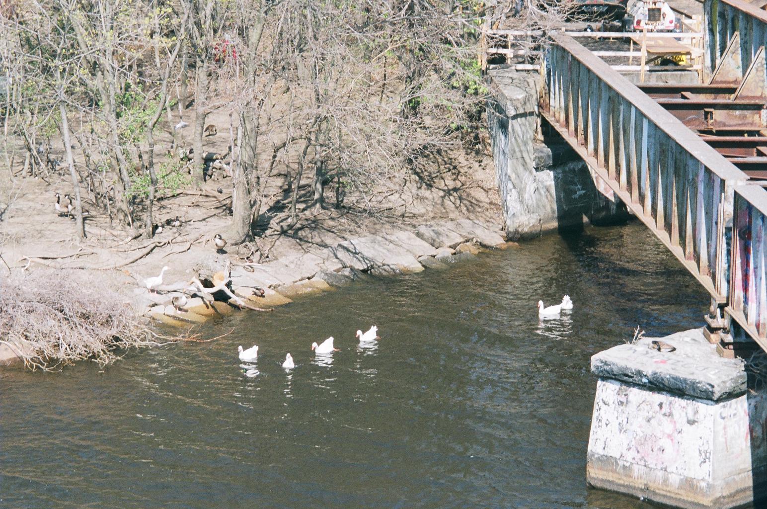
This is a shot of the river edge from April 28, 2013. The native vegetation is heavy ground vegetation. That was destroyed, quite clearly by the falsely named Charles River “Conservancy” which destroys ground vegetation for the Department of Conservation and Recreation, which, in turn, coordinates its destruction with Cambridge. You can see some Canadas and at least one Charles River White Goose in this area. The geese would be in this area to keep safe from the irresponsible private vehicle use in the area on the far side of the trees.
[03-26 CVS 2204 03-24-13 DNA]

It does not look like much. This area was heavily vegetated before destruction as part of the BU Bridge work. Native vegetation is at the very top, bordering on the parking destruction. This entire area was like the native vegetation, which is extremely nice in season. Some geese were in the native vegetation. A lot were in the introduced vegetation, which is a bit bigger now. Many were in the bare area to the right of the introduced stuff.
The treed area at the top right is the opposite view of the area in the preceding photograph. The shadow on the right is from the BU Bridge.
[04-28, CVS 23 03 04-28 DNA]

This is a closer view of the native vegetation. The border line between native and introduced is the wall of black plastic which was the boundary of the BU Bridge construction zone. This black wall is the sort of stuff that Cambridge and the DCR would try to lie is “native” until it is clear that people are not that stupid. Then they resort to bragging of incompetence. They are very proud of their incompetence.
Under the big tree at the top is where the Charles River White Geese have spent their days and nights since Cambridge and the DCR started deliberately starving them. Now that is not safe for them. The irresponsible parking by railroad workers with the clear consent of the DCR continues where the vehicles are seen.
[04-28, CVS, 24 02 04-28 DNA]

This is a closer view of the undestroyed native vegetation. The foot of the big tree is at the very top.
[03-26, CVS 0125 03-18-13]

This is the entrance to the Destroyed Nesting Area. The actual opening is to the top left, illegally created by Boston University for the DCR / Cambridge in October 1999. The grey areas are introduced crushed rock, not even the people we are so unfortunate as to deal with would dare call this native. The nearer portion seems to be the predecessor for the east - west highway that Governor Patrick is seeking bond authorization for, $24 million including destruction of hundreds of trees between here an the Longfellow Bridge, two bridges to the east. This grey area is part of a reverse fork coming from the illegal opening. The other fork would apparently lead to the Cambridge City Council’s planned, and equally outrageous, north - south highway.
Yesterday, there were quite a few geese in the introduced vegetation to the left.
The grey area at the very top of the photo is the on ramp to Memorial Drive.
It is currently extremely busy during rush hour because the Memorial Drive overpass is closed for repairs and the on ramp is now Memorial Drive.
[04-28, CVS 10 16 04-03 Mem Dr, Rotary]

This shot is of where responsible workers park on the river side of the Memorial Drive overpass between the structure and the highway. These are workers preparing the overpass repair before the overpass was shut down. The shot is taken from just outside the illegal opening. The car to the right is on the on ramp.
[04-28, CVS 11 15 04-03 Mem Dr East]

This is where the railroad workers who are parking in the Destroyed Nesting Area should be parking. It, also, is before the closure. One big difference now, especially during rush hour, is a State Police officer in the intersection and a lot of cars which were on Memorial Drive.
[04-28, CVS 25 01 04-28 Mem Dr, East]

This is a shot of the same area after closure. Behind the camera is an illegally (Boston University, October 1999, again) installed staircase which directly leads to where the railroad workers are parking and working.
The car is in approximately the same location where a contingent of Charles River White Geese crossed yesterday afternoon in the evening rush hour.
There were a lot of babies, many pretty big now. I assisted them. They are responsible pedestrians. They stayed near the sidewalk, not visible on the left, until there was a break in the traffic. Their problem as pedestrians is that they are geese. They diddle. There were several lagging adults whom I shushed to get them moving. The break was because the office had changed traffic direction in the intersection. Some cars came while I was shushing over the last few. Drivers and pedestrians were very supportive of the gaggle group. The pedestrians were very supporting of my efforts.
The Charles River White Geese are forced to cross this off ramp because they have no other food.
Cambridge and the DCR are deliberately starving them by the bizarre walk blocking access to the Magazine Beach playing fields from the Charles River. The playing fields have been their primary source of food for most of the 32 years they have lived on the Charles River.
The corrupt behavior by the Cambridge Machine in their recent fake “vote” was necessary because decent condemn the outrages on the Charles River.
So the Cambridge Machine, with its contempt for ethics, the environment and common decency, simply stole that vote and continually does a lot of lying by omission.
Subscribe to:
Posts (Atom)